Golis Mountains
| Golis | |
|---|---|
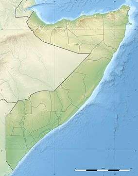 Golis Location of Golis in Somalia | |
| Highest point | |
| Elevation | 1,371 m (4,498 ft) [1] |
| Coordinates | 9°52′0″N 44°55′0″E / 9.86667°N 44.91667°ECoordinates: 9°52′0″N 44°55′0″E / 9.86667°N 44.91667°E |
| Geography | |
| Location | Somalia |
The Golis Mountains are a mountain range in northern Somalia. Also known as Qar Golis, they cut through the Togdheer region.[1]
See also
Notes
- 1 2 "Golis Range, Somalia". Getamap. Retrieved 23 June 2013.
References
- Abdullahi, Mohamed Diriye (2001). Culture and customs of Somalia. Greenwood. ISBN 978-0-313-31333-2.
External links
- "Qar Goliis, Somalia". Collins Maps. Retrieved 23 June 2013.
This article is issued from
Wikipedia.
The text is licensed under Creative Commons - Attribution - Sharealike.
Additional terms may apply for the media files.