Franklin Township, Harrison County, Indiana
| Franklin Township | |
|---|---|
| Township | |
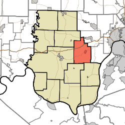 Location in Harrison County | |
| Coordinates: 38°14′23″N 86°00′20″W / 38.23972°N 86.00556°WCoordinates: 38°14′23″N 86°00′20″W / 38.23972°N 86.00556°W | |
| Country | United States |
| State | Indiana |
| County | Harrison |
| Government | |
| • Type | Indiana township |
| Area | |
| • Total | 34.91 sq mi (90.4 km2) |
| • Land | 34.89 sq mi (90.4 km2) |
| • Water | 0.02 sq mi (0.05 km2) 0.06% |
| Elevation | 830 ft (253 m) |
| Population (2010) | |
| • Total | 4,104 |
| • Density | 117.6/sq mi (45.4/km2) |
| GNIS feature ID | 0453303 |
Franklin Township is one of twelve townships in Harrison County, Indiana, United States. As of the 2010 census, its population was 4,104 and it contained 1,676 housing units.[1]
Geography
According to the 2010 census, the township has a total area of 34.91 square miles (90.4 km2), of which 34.89 square miles (90.4 km2) (or 99.94%) is land and 0.02 square miles (0.052 km2) (or 0.06%) is water.[1] The streams of Lazy Creek, Little Indian Creek, Smith Creek and Woertz Creek run through this township.
Cities and towns
Unincorporated towns
(This list is based on USGS data and may include former settlements.)
Adjacent townships
- Georgetown Township, Floyd County (northeast)
- Franklin Township, Floyd County (east)
- Posey Township (southeast)
- Webster Township (southwest)
- Harrison Township (west)
- Jackson Township (northwest)
Cemeteries
The township contains one cemetery, Lanesville.
Major highways
Airports and landing strips
- Greenridge KLA Airport
- Lanesville Skyways Airport
References
- "Franklin Township, Harrison County, Indiana". Geographic Names Information System. United States Geological Survey. Retrieved 2009-09-24.
- United States Census Bureau cartographic boundary files
- 1 2 "Population, Housing Units, Area, and Density: 2010 - County -- County Subdivision and Place -- 2010 Census Summary File 1". United States Census. Retrieved 2013-05-10.
External links
Municipalities and communities of Harrison County, Indiana, United States | ||
|---|---|---|
| Towns | ||
| Townships | ||
| CDP | ||
| Other unincorporated communities |
| |
| Ghost town | ||
| Footnotes | ‡This populated place also has portions in an adjacent county or counties | |
This article is issued from
Wikipedia.
The text is licensed under Creative Commons - Attribution - Sharealike.
Additional terms may apply for the media files.