Blue River Township, Harrison County, Indiana
| Blue River Township | |
|---|---|
| Township | |
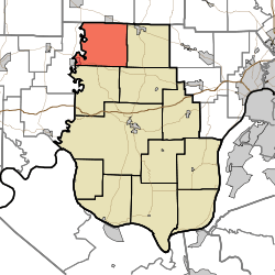 Location in Harrison County | |
| Coordinates: 38°22′40″N 86°12′50″W / 38.37778°N 86.21389°WCoordinates: 38°22′40″N 86°12′50″W / 38.37778°N 86.21389°W | |
| Country | United States |
| State | Indiana |
| County | Harrison |
| Government | |
| • Type | Indiana township |
| Area | |
| • Total | 38.65 sq mi (100.1 km2) |
| • Land | 38.44 sq mi (99.6 km2) |
| • Water | 0.22 sq mi (0.6 km2) 0.57% |
| Elevation | 748 ft (228 m) |
| Population (2010) | |
| • Total | 2,064 |
| • Density | 53.7/sq mi (20.7/km2) |
| GNIS feature ID | 0453118 |
Blue River Township is one of twelve townships in Harrison County, Indiana, United States. As of the 2010 census, its population was 2,064 and it contained 889 housing units.[1]
Geography
According to the 2010 census, the township has a total area of 38.65 square miles (100.1 km2), of which 38.44 square miles (99.6 km2) (or 99.46%) is land and 0.22 square miles (0.57 km2) (or 0.57%) is water.[1] The stream of Baldy Creek runs through this township.
Cities and towns
- Milltown (east half)
Unincorporated towns
(This list is based on USGS data and may include former settlements.)
Adjacent townships
- Posey Township, Washington County (north)
- Morgan Township (east)
- Jackson Township (southeast)
- Spencer Township (south)
- Whiskey Run Township, Crawford County (west)
Cemeteries
The township contains four major cemeteries: Boston, Breedlove, Mount Zion and Reno.
Major highways
References
- "Blue River Township, Harrison County, Indiana". Geographic Names Information System. United States Geological Survey. Retrieved 2009-09-24.
- United States Census Bureau cartographic boundary files
- 1 2 "Population, Housing Units, Area, and Density: 2010 - County -- County Subdivision and Place -- 2010 Census Summary File 1". United States Census. Retrieved 2013-05-10.
External links
Municipalities and communities of Harrison County, Indiana, United States | ||
|---|---|---|
| Towns | ||
| Townships | ||
| CDP | ||
| Other unincorporated communities |
| |
| Ghost town | ||
| Footnotes | ‡This populated place also has portions in an adjacent county or counties | |
This article is issued from
Wikipedia.
The text is licensed under Creative Commons - Attribution - Sharealike.
Additional terms may apply for the media files.