Boone Township, Harrison County, Indiana
| Boone Township | |
|---|---|
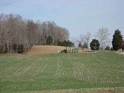 Countryside in the township's northwest | |
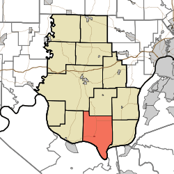 Location in Harrison County | |
| Coordinates: 38°02′57″N 86°04′26″W / 38.04917°N 86.07389°WCoordinates: 38°02′57″N 86°04′26″W / 38.04917°N 86.07389°W | |
| Country | United States |
| State | Indiana |
| County | Harrison |
| Government | |
| • Type | Indiana township |
| Area | |
| • Total | 47.65 sq mi (123.4 km2) |
| • Land | 47.31 sq mi (122.5 km2) |
| • Water | 0.34 sq mi (0.9 km2) 0.71% |
| Elevation | 673 ft (205 m) |
| Population (2010) | |
| • Total | 1,391 |
| • Density | 29.4/sq mi (11.4/km2) |
| GNIS feature ID | 0453128 |
Boone Township is one of 12 townships in Harrison County, Indiana, United States. As of the 2010 census, its population was 1,391 and it contained 628 housing units.[1]
History
Boone Township is named after Squire Boone who settled in the township in 1806. He died there in 1815 and is buried in the nearby Squire Boone Caverns. Boone built the first Baptist church in Indiana in the Boone Township in 1813. The church is called Old Goshen Church and has been reconstructed.
Kintner-Withers House was added to the National Register of Historic Places in 1980.[2]
Geography
According to the 2010 census, the township has a total area of 47.65 square miles (123.4 km2), of which 47.31 square miles (122.5 km2) (or 99.29%) is land and 0.34 square miles (0.88 km2) (or 0.71%) is water.[1] The streams of Big Run, Mays Branch and West Branch Mosquito Creek run through this township.
Cities and towns
Unincorporated towns
- Cedar Farm Landing
- Davidson
- Gurley Landing
- Rehoboth
- Tobacco Landing
(This list is based on USGS data and may include former settlements.)
Education
The children of Boone Township attend South Central school which is part of the South Harrison School District.
Adjacent townships
- Webster Township (north)
- Posey Township (northeast)
- Taylor Township (east)
- Heth Township (west)
- Harrison Township (northwest)
Cemeteries
The township contains 43 documented cemeteries: Able, Barger, Becky Brown Family Plot, Beswick/Radmacher's, Brown Family Cemetery (aka Old Stephen's), Chaffin, Cole, Collen's Chapel, Cotner, Crosier, Dodd/Kings, Dunkard, Eckart, Ellis, Entrician/Endrocrane, Ferree/May, Grey, Guest, John Brown Cemetery, Kinzer/Lightner, Laconia Methodist (Bethel), Lane, Lewis, Madden, Marsh Burying Ground, McIntire (Evan's), Memorial Baptist/Presbyterian, Nancy Brown Plot, Old Goshen, Payton, Philip Rupp's Grave, Phillips Cemetery, Reed, Rehobeth, Ridley, Sacred Heart of Mary Catholic Cemetery, Sands, Stallings, Stephens, Union Chapel, unnamed Boone and Zimmerman family cemetery.
Major highways
References
- "Boone Township, Harrison County, Indiana". Geographic Names Information System. United States Geological Survey. Retrieved September 24, 2009.
- United States Census Bureau cartographic boundary files
- 1 2 "Population, Housing Units, Area, and Density: 2010 - County -- County Subdivision and Place -- 2010 Census Summary File 1". United States Census. Retrieved 2013-05-10.
- ↑ National Park Service (2010-07-09). "National Register Information System". National Register of Historic Places. National Park Service.
External links
Municipalities and communities of Harrison County, Indiana, United States | ||
|---|---|---|
| Towns | ||
| Townships | ||
| CDP | ||
| Other unincorporated communities |
| |
| Ghost town | ||
| Footnotes | ‡This populated place also has portions in an adjacent county or counties | |