Franekeradeel
| Franekeradeel Frentsjerteradiel | |||
|---|---|---|---|
| Municipality | |||
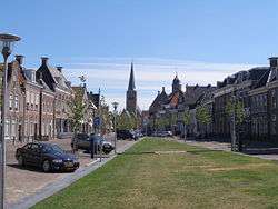 City of Franeker | |||
| |||
.svg.png) Location in Friesland | |||
| Coordinates: 53°11′N 5°32′E / 53.183°N 5.533°ECoordinates: 53°11′N 5°32′E / 53.183°N 5.533°E | |||
| Country | Netherlands | ||
| Province | Friesland | ||
| Government[1] | |||
| • Body | Municipal council | ||
| • Mayor | Fred Veenstra (CDA) | ||
| Area[2] | |||
| • Total | 109.17 km2 (42.15 sq mi) | ||
| • Land | 102.73 km2 (39.66 sq mi) | ||
| • Water | 6.44 km2 (2.49 sq mi) | ||
| Elevation[3] | 1 m (3 ft) | ||
| Population (August 2017)[4] | |||
| • Total | 20,236 | ||
| • Density | 197/km2 (510/sq mi) | ||
| Time zone | UTC+1 (CET) | ||
| • Summer (DST) | UTC+2 (CEST) | ||
| Postcode | 8800–8814, 8850–8859 | ||
| Area code | 0517, 0518 | ||
| Website |
www | ||


Franekeradeel (Dutch pronunciation: [ˈfraːnəkəraːˌdeːl] (![]()
Population centres
Achlum, Boer, Dongjum, Firdgum, Franeker, Herbaijum, Hitzum, Klooster-Lidlum, Oosterbierum, Peins, Pietersbierum, Ried, Schalsum, Sexbierum, Tzum, Tzummarum, Zweins.
Topography
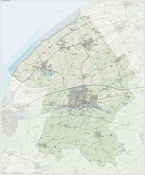
Dutch Topographic map of the municipality of Franekeradeel, June 2015
References
- ↑ "College van burgemeester en wethouders" [Board of mayor and aldermen] (in Dutch). Gemeente Franekeradeel. Retrieved 9 September 2013.
- ↑ "Kerncijfers wijken en buurten" [Key figures for neighbourhoods]. CBS Statline (in Dutch). CBS. 2 July 2013. Retrieved 12 March 2014.
- ↑ "Postcodetool for 8801PA". Actueel Hoogtebestand Nederland (in Dutch). Het Waterschapshuis. Archived from the original on 21 September 2013. Retrieved 9 September 2013.
- ↑ "Bevolkingsontwikkeling; regio per maand" [Population growth; regions per month]. CBS Statline (in Dutch). CBS. 27 October 2017. Retrieved 27 October 2017.
External links
![]()
Neighbouring municipalities at time of dissolution | ||||||||||
|---|---|---|---|---|---|---|---|---|---|---|
| ||||||||||
Municipalities of Friesland | ||
|---|---|---|
 | ||
| ||
This article is issued from
Wikipedia.
The text is licensed under Creative Commons - Attribution - Sharealike.
Additional terms may apply for the media files.