Dongeradeel
| Dongeradeel Dongeradiel | |||
|---|---|---|---|
| Municipality | |||
 Canal through Dokkum | |||
| |||
.svg.png) Location in Friesland | |||
| Coordinates: 53°20′N 6°0′E / 53.333°N 6.000°ECoordinates: 53°20′N 6°0′E / 53.333°N 6.000°E | |||
| Country | Netherlands | ||
| Province | Friesland | ||
| Established | 1 January 1984 | ||
| Government[1] | |||
| • Body | Municipal council | ||
| • Mayor | Marga Waanders (PvdA) | ||
| Area[2] | |||
| • Total | 266.92 km2 (103.06 sq mi) | ||
| • Land | 167.21 km2 (64.56 sq mi) | ||
| • Water | 99.71 km2 (38.50 sq mi) | ||
| Elevation[3] | 4 m (13 ft) | ||
| Population (August 2017)[4] | |||
| • Total | 23,848 | ||
| • Density | 143/km2 (370/sq mi) | ||
| Time zone | UTC+1 (CET) | ||
| • Summer (DST) | UTC+2 (CEST) | ||
| Postcode | 9100–9156 | ||
| Area code | 0519 | ||
| Website |
www | ||


Dongeradeel (![]()
History
Dongeradeel was created in 1984 from the merging of the old municipalities Westdongeradeel, Oostdongeradeel, and Dokkum. The new municipality is still colloquially referred to in the plural, "de Dongeradelen".
Population centres
Aalsum, Anjum, Bornwird, Brantgum, Dokkum, Ee, Engwierum, Foudgum, Hantum, Hantumeruitburen, Hantumhuizen, Hiaure, Holwerd, Jouswier, Lioessens, Metslawier, Moddergat, Morra, Nes, Niawier, Oosternijkerk, Oostmahorn, Oostrum, Paesens, Raard, Ternaard, Waaxens, Wetsens, Wierum.
Topography
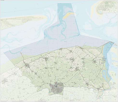
Dutch Topographic map of the municipality of Dongeradeel, June 2015.
References
- ↑ "Collegeleden" [Members of the executive board] (in Dutch). Gemeente Dongeradeel. Retrieved 8 September 2013.
- ↑ "Kerncijfers wijken en buurten" [Key figures for neighbourhoods]. CBS Statline (in Dutch). CBS. 2 July 2013. Retrieved 12 March 2014.
- ↑ "Postcodetool for 9101LP". Actueel Hoogtebestand Nederland (in Dutch). Het Waterschapshuis. Retrieved 8 September 2013.
- ↑ "Bevolkingsontwikkeling; regio per maand" [Population growth; regions per month]. CBS Statline (in Dutch). CBS. 27 October 2017. Retrieved 27 October 2017.
External links

- Official website
Places adjacent to Dongeradeel | |
|---|---|
Municipalities of Friesland | ||
|---|---|---|
 | ||
| ||