Fisher, Australian Capital Territory
| Fisher Canberra, Australian Capital Territory | |||||||||||||||
|---|---|---|---|---|---|---|---|---|---|---|---|---|---|---|---|
 | |||||||||||||||
| Coordinates | 35°21′40″S 149°03′25″E / 35.361°S 149.057°ECoordinates: 35°21′40″S 149°03′25″E / 35.361°S 149.057°E | ||||||||||||||
| Population | 3,004 (2016 census)[1] | ||||||||||||||
| • Density | 1,880/km2 (4,860/sq mi) | ||||||||||||||
| Established | 1970 | ||||||||||||||
| Postcode(s) | 2611 | ||||||||||||||
| Area | 1.6 km2 (0.6 sq mi) | ||||||||||||||
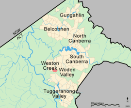
| District | Weston Creek | ||||||||||||||
| Territory electorate(s) | Murrumbidgee | ||||||||||||||
| Federal Division(s) | Canberra | ||||||||||||||
| |||||||||||||||
Fisher is a suburb of Canberra, Australian Capital Territory, Australia located in the district of Weston Creek. Fisher was named after Andrew Fisher (1862–1928), coal miner, founding member of the federal parliamentary Labor Party and Prime Minister of Australia for three terms between 1908 and 1915 (ACTLIC, 2004).[2] The theme for the street names in Fisher is Australian mines and mining towns (ACTPLA, 2003).[2]

Fisher shopping centre
Geology
Laidlaw Volcanics pale to dark grey dacitic tuff is found though most of Fisher except north slice of the suburb which is Deakin Volcanics red-purple and green grey rhyodacite with spherulitic texture.[3]
References
| Wikimedia Commons has media related to Fisher, Australian Capital Territory. |
- ↑ Australian Bureau of Statistics (27 June 2017). "Fisher (State Suburb)". 2016 Census QuickStats. Retrieved 1 July 2017.

- 1 2 "Suburb Name search results". ACT Environment and Sustainable Development. Retrieved 13 February 2014.
- ↑ Henderson, G. A. M.; Matveev, G. (1980). Geology of Canberra, Queanbeyan and Environs (Map). 1:50000.
This article is issued from
Wikipedia.
The text is licensed under Creative Commons - Attribution - Sharealike.
Additional terms may apply for the media files.