Finzel, Maryland
| Finzel, Maryland | |
|---|---|
| Census-designated place | |
 Finzel  Finzel | |
| Coordinates: 39°42′52″N 78°56′43″W / 39.71444°N 78.94528°WCoordinates: 39°42′52″N 78°56′43″W / 39.71444°N 78.94528°W | |
| Country | United States |
| State | Maryland |
| County | Garrett |
| Area[1] | |
| • Total | 3.291 sq mi (8.52 km2) |
| • Land | 3.291 sq mi (8.52 km2) |
| • Water | 0 sq mi (0 km2) |
| Elevation | 2,543 ft (775 m) |
| Population (2010)[2] | |
| • Total | 547 |
| • Density | 170/sq mi (64/km2) |
| Time zone | UTC-5 (Eastern (EST)) |
| • Summer (DST) | UTC-4 (EDT) |
| Area code(s) | 240 & 301 |
| GNIS feature ID | 590209[3] |
Finzel is a census-designated place (CDP) in Garrett County, Maryland, United States. Finzel is located on Maryland Route 546 near the Pennsylvania border. As of the 2010 census, its population was 547.[2]
References
- ↑ "US Gazetteer files: 2010, 2000, and 1990". United States Census Bureau. 2011-02-12. Retrieved 2011-04-23.
- 1 2 "American FactFinder". United States Census Bureau. Archived from the original on 2013-09-11. Retrieved 2011-05-14.
- ↑ "Finzel". Geographic Names Information System. United States Geological Survey.
Municipalities and communities of Garrett County, Maryland, United States | ||
|---|---|---|
| Towns | 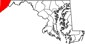 | |
| CDPs | ||
| Unincorporated communities | ||
| Ghost town | ||
| Footnotes | ‡This populated place also has portions in an adjacent county or counties | |
This article is issued from
Wikipedia.
The text is licensed under Creative Commons - Attribution - Sharealike.
Additional terms may apply for the media files.