Farningham
| Farningham | |
|---|---|
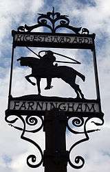 Village sign | |
 Farningham Farningham shown within Kent | |
| Population | 1,319 (2011 Census)[1] |
| OS grid reference | TQ5466 |
| Civil parish |
|
| District | |
| Shire county | |
| Region | |
| Country | England |
| Sovereign state | United Kingdom |
| Post town | Dartford |
| Postcode district | DA4 |
| Dialling code | 01322 |
| Police | Kent |
| Fire | Kent |
| Ambulance | South East Coast |
| EU Parliament | South East England |
| UK Parliament | |
Farningham is a village and civil parish in the Sevenoaks District of Kent, England. It borders the Dartford Borough and is located on the River Darent, 3 miles south east of Swanley. It has a population of 1,289,[2] increasing to 1,319 at the 2011 Census.[1] The M20 motorway and the A20 road both pass through the parish. It has three pubs, an Indian restaurant, a furniture shop, an antique book shop and a village store.
History
Farningham is believed to be home to Neolithic history – flint and other tools have been discovered and can be found in the Dartford Museum. The Romans occupied the general area after their invasion in the 1st century and, along with large evidence of habitation down the road in Lullingstone, there is also evidence of Roman habitation in Farningham. Three farmhouses and three villas have been unearthed. Charles Dickens was a visitor during his time for the trout fishing that the Darent provided.
The Domesday Book records that before the Norman conquest, Farningham was owned by an Anglo Saxon thane called Alstan.[3]
In the nineteenth century Farningham was adopted as the assumed surname of Marianne Farningham, a religious writer and editor, who was born here.[4]
Used only for WW1 there used to be an airfield used by the RAF for emergency landings.
The parish church is dedicated to St Peter and St Paul.
The parish was part of Axstane Hundred and later Dartford Rural District.
Transport
Roads
Farningham is situated upon the historic route of the A20, Kent's second major road between the capital and the channel ports. The village itself, with its narrow bridge over the River Darenth, and its narrow streets, was bypassed to the north east in the 1930s. The A225 runs along the Darenth valley and intersects the A20 at the village. The construction of the first sections of the M25 motorway and M20 motorway in the late 1970s bypassed the village again.
Rail
The closest National Rail station is Eynsford, and it is located 2 miles away.
Buses
- 421 to Swanley and to Sevenoaks, ran by Go Coach Hire (Mondays to Saturdays)
- 429 to Dartford via Swanley and to West Kingsdown, ran by Go Coach Hire (Mondays to Saturdays)
- 429 to Bluewater via Swanley and Dartford and to West Kingsdown, ran by Go Coach Hire (Sundays)
Mills
Farningham had a watermill, powered by the River Darent, the building of which survives. There was a windmill at Chimham's Farm, which was moved in 1880 to West Kingsdown, where it still stands.
Sport
Home to Farningham Cricket Club along Horton Way the club has been in existence since 1857 providing cricketing facilities for the local community. Currently fielding two senior league Saturday teams and one Sunday friendly team along with a thriving junior section.
References
- 1 2 "Civil Parish population 2011". Neighbourhood Statistics. Office for National Statistics. Retrieved 18 September 2016.
- ↑ Office for National Statistics : Census 2001 : Parish Headcounts : Sevenoaks Retrieved 22 January 2010
- ↑ Wadard and Vital
- ↑

External links
| Wikimedia Commons has media related to Farningham. |