Knockholt
| Knockholt | |
|---|---|
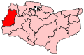
 Knockholt Knockholt shown within Kent | |
| Area | 2.63 sq mi (6.8 km2) |
| Population | 1,222 (2011 Census)[1] |
| • Density | 465/sq mi (180/km2) |
| OS grid reference | TQ467589 |
| Civil parish |
|
| District | |
| Shire county | |
| Region | |
| Country | England |
| Sovereign state | United Kingdom |
| Post town | SEVENOAKS |
| Postcode district | TN14 |
| Dialling code | 01959 |
| Police | Kent |
| Fire | Kent |
| Ambulance | South East Coast |
| EU Parliament | South East England |
| UK Parliament | |
Knockholt is a village and civil parish in the Sevenoaks District of Kent, England, lying approximately 5 miles (8.0 km) south of Orpington and 3 miles (4.8 km) northwest of Sevenoaks. It has a long border with Greater London. Some 1,222 people are recorded as lived in the parish at the 2011 Census showing a decennial rise from 1,166.[1]
The village is mostly a ribbon development, surrounded by fields that are a part of the Green Belt. There is mixed arable farming. It is in a hilly, rural location, on the top of the dip slope of the North Downs, and has views over London. The village name has the unusually late, mid-19th century more common spelling Nockholt, and is one of many villages in England with a derivation from oak trees, most a strong departure from today's spelling of oak such as Aike.
History
The village's name is derived from the Anglo-Saxon āc-holt meaning "oak copse".[2] Knockholt was included in Orpington Urban District in 1934.[3] When Greater London was created in 1965, as part of Orpington UD, Knockholt was included in the London Borough of Bromley. On 1 April 1969, following a concerted campaign by villagers it was removed from the Borough and returned to Kent, being included in Sevenoaks Rural District.[4]
| “ | NOCKHOLT, a parish, in the [Poor Law] union of Bromley, hundred of Ruxley, lathe of Sutton-at-Hone, W. division of Kent, 5 miles (N. W.) from Seven-Oaks; containing 539 inhabitants. It consists of 1683 acres, of which 516 are in wood. The living [priest's benefice] is a perpetual curacy; net income, £102; patron, the [lay] impropriator of [the rectory of] Orpington: the tithes have been commuted [cut with chancel repairs apportioned] for £250, and the glebe comprises 3 acres. The church is a neat structure. There is a place of worship for Wesleyans. — A Topographical Dictionary of England, 1848[5] | ” |
The area of the parish is virtually unchanged since first drawn in the late medieval period.[6] When it temporarily merged into Orpington (in 1934) and fell under Bromley Rural District, it was 1701 acres, 18 more than in 1848.[7]
The Ivy Farm Communications Centre at Knockholt Pound was the Radio Intercept Station for the non-Morse radio traffic, known as Fish, decoded by Bletchley Park during World War II. The importance of the station is noted in Paul Gannon's book.[8]
There are two parts to the village, Knockholt, near the church and school and The Pound, near the Three Horseshoes pub, village shop and garage (Ox in Flames). There are two other pubs, the Harrow and Tally Ho, as well as a village club.
St Katharine's Church, a Grade II*-listed building, is the Anglican parish church.[9] Near Knockholt Pound is the London Road Evangelical Church, built in the late 19th century as a Methodist chapel.[10] Its registration on behalf of the denomination was cancelled in July 1967,[11] and in August 1968 it was re-registered for Evangelical use.[12] Opposite the parish church is St Katharine's Church of England Primary School.
Transport
Knockholt railway station sits 2 miles (3.2 km) north of the village on the old A21 near Halstead and Badgers Mount and is just within Greater London. Three buses serve the village: the Transport for London services R5 and R10 in a loop from Knockholt to Orpington, and the Go-Coach Bus 431 to Sevenoaks and Orpington.[13] Until 23 July 2017, Arriva ran the 402 bus route through Knockholt, but cut the service due to low passenger numbers.[14]
Local activities
Knockholt residents host a village carnival every two years, the most recent being in July 2018, and a fireworks night every year, late October to early November. Funds raised through these and other events go to national and local charities. A new regular event in the village is the Knockstock music festival, starting in July 2013 and with plans to run in alternating years when the carnival is not operating.
Knockholt Amateur Theatrical Society produce one play and pantomime every year. This charitable society was formed in 1945. Kytens is the local youth amateur theatrical group linked to KATS above. There are many other groups including Bowls, Cricket, Tennis, Horse Riding, Horticulture, Christian Fellowship. This is a popular area for horse riders, walkers, ramblers and cyclists, due to its beauty.
Knockholt Cricket Club completed the 2009 season unbeaten in the Kent County Village League (KCVL) Division 3, which was believed to be a KCVL first.
See also
References
- 1 2 "Civil Parish population 2011". Neighbourhood Statistics. Office for National Statistics. Retrieved 19 September 2016.
- ↑ Reaney, P. H. The Origins of English Place-Names (1980 ed.). Routledge and Kegan Paul. p. 37.
- ↑ "Orpington CP/AP". Great Britain Historical GIS (A Vision of Britain Through Time). University of Portsmouth and others. 2009. Retrieved 23 November 2012.
- ↑ "Knockholt CP/CP/Ch". Great Britain Historical GIS (A Vision of Britain Through Time). University of Portsmouth and others. 2009. Retrieved 23 November 2012.
- ↑ A Topographical Dictionary of England, ed. Samuel Lewis (London, 1848), pp. 416-421. British History Online http://www.british-history.ac.uk/topographical-dict/england/pp416-421a [accessed 26 May 2018].
- ↑ https://www.achurchnearyou.com/search/?lat=51.311086&lon=0.10619999999994434&place=ChIJsaHILAVT30cRbH10JP7QdR0&text=
- ↑ http://www.visionofbritain.org.uk/unit/10225048
- ↑ Paul Gannon. Colossus: Bletchley Park's Greatest Secret. Atlantic Books, London. 2006
- ↑ Historic England. "Details from listed building database (1273386)". National Heritage List for England. Retrieved 23 November 2012.
- ↑ Homan, Roger (1984). The Victorian Churches of Kent. Chichester: Phillimore & Co. p. 68. ISBN 0-85033-466-7.
- ↑ "No. 44377". The London Gazette. 1 August 1967. p. 8474.
- ↑ "No. 44660". The London Gazette. 23 August 1968. p. 9303.
- ↑ http://www.go-coach.co.uk/bus/timetables/114
- ↑ http://www.bromleytimes.co.uk/news/bromley-losing-connection-to-kent-with-cut-to-402-bus-service-1-5078542
External links
| Wikimedia Commons has media related to Knockholt. |