Tira, Israel
Tira
| ||
|---|---|---|
| Hebrew transcription(s) | ||
| • ISO 259 | Ṭira | |
| • Also spelled | Tire (official) | |
 | ||
| ||
 Tira | ||
| Coordinates: 32°13′56″N 34°56′54″E / 32.23222°N 34.94833°ECoordinates: 32°13′56″N 34°56′54″E / 32.23222°N 34.94833°E | ||
| Grid position | 145/182 PAL | |
| District | Central | |
| Government | ||
| • Type | City | |
| • Mayor | Mamoun Abd al-Hay | |
| Area | ||
| • Total | 11,894 dunams (11.894 km2 or 4.592 sq mi) | |
| Population (2017)[1] | ||
| • Total | 25,721 | |
| • Density | 2,200/km2 (5,600/sq mi) | |
| Name meaning | The High Land | |
.svg.png)
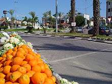
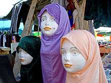
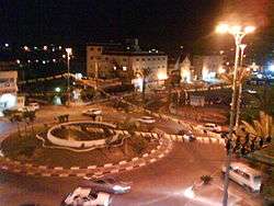
Tira (Arabic: الطـّيرة al-Tira, Hebrew: טִירָה), lit. "The Fort")[2] is a predominantly Arab city in the Central District of Israel. Part of The Triangle, a concentration of Israeli Arab towns and villages adjacent to the Green Line, Tira is close to Kfar Saba, a larger Jewish city, and is well known by its neighbors for its weekly outdoor market, as well as for its Arab cuisine. In 2017 it had a population of 25,721.[1]
History
In the 12th century, during the Crusader period, the village was owned by the Order of St. John. It was lease to Robert of Sinjil and his heirs. In the 14th and 15th century, Tira was a stop on the road between Gaza and Damascus,[3] and a khan was constructed.[4]
Ottoman era
Pierre Jacotin called the village Ertahah on his map from 1799.[5] In 1882, the Palestine Exploration Fund's Survey of Western Palestine described Tira as: "A conspicuous village on a knoll in the plain, surrounded by olives, with a well on the west side."[6]
British Mandate era
In the 1922 census of Palestine conducted by the British Mandate authorities, Tireh had a population of 1,588 inhabitants; 1,582 Muslims and 6 Christians,[7] increasing in the 1931 census to 2,192; 2,190 Muslims and 2 Christians, in a total of 380 houses.[8]
In the 1945 statistics, it had 3,180 Arab inhabitants, who owned a total of owned 26,803 dunams of land.[9]
Demographics
According to CBS, in 2004 the ethnic makeup of the city was 99.9% Sunni Muslim Arab citizens of Israel (see also: Population groups in Israel).
A small number of Jews also live in Tira, mainly due to the cheaper housing costs offered by Tira than in many Jewish localities, such as nearby Kfar Saba.[10]
According to CBS, in 2001 there were 9,600 males and 9,300 females. The population of the city was spread out with 47.4% 19 years of age or younger, 16.2% between 20 and 29, 19.9% between 30 and 44, 10.8% from 45 to 59, 1.8% from 60 to 64, and 3.8% 65 years of age or older. The population growth rate in 2001 was 2.8%. In 2004, 41.3% of the population was 17 years or younger, 54.5% were between 18 and 64 years of age, and 4.2% were aged 65 and above.
Income
According to CBS, as of 2000, in the city there were 3,654 salaried workers and 953 are self-employed. The mean monthly wage in 2000 for a salaried worker in the city is ILS 3,767, a real change of 2.4% over the course of 2000. Salaried males have a mean monthly wage of ILS 4,494 (a real change of 6.1%) versus ILS 2,319 for females (a real change of −13.0%). The mean income for the self-employed is 4,289. There are 69 people who receive unemployment benefits and 1,183 people who receive an income guarantee. In 2004, 41.9% of the population was part of the workforce.
Education
According to CBS, there are 10 schools and 4,735 students in the city. They are spread out as seven elementary schools with 2,896 elementary school students, and three high schools with 1,839 high school students. Of 12th grade students, 64.8% were entitled to a matriculation certificate in 2001.
In 2004, 6.5% of the population had 0 years of education, 17.1% had up to 8 years, 55% had 9 to 12 years, 11.8% had 13–15 years, and 9.7% had 16 or more years of education. Ten percent had an academic degree.
The city's schools include:
- Al-Zahraa
- Al-Najah
- Al-G'azali
- Al-Majd
- Al-Aomareya
- Junior High A
- Junior High B
- Junior High c(g)
- Amal 1- Ibrahim Qsaem High School
- Technological High School
- Tira's Science High School
Many high school students from Tira study at high schools outside of Tira. Tira's students are among of the best students from Israel's Arab sector. Many high schoolers from Tira have received scholarships from Israeli universities and participate in exchange programs such as Y.E.S (Bureau of Educational and Cultural Affairs), Seeds of Peace, and CISV.
Sister cities
Tira is twinned with:
Notable residents
See also
References
- 1 2 "List of localities, in Alphabetical order" (PDF). Israel Central Bureau of Statistics. Retrieved August 26, 2018.
- ↑ Palmer, 1881, p.194
- ↑ Petersen, 2001, p. 307, citing al-Zahri ed. Ravaisse, 199, Hartmann 1910, 689
- ↑ Petersen, 2001, p.307, citing al-Umari ed. Shams al-Din
- ↑ Karmon, 1960, p. 170
- ↑ Conder and Kitchener, 1882, SWP II, p. 166
- ↑ Barron, 1923, Table IX, Sub-district of Tulkarem, p. 28
- ↑ Mills, 1932, p. 58
- ↑ Government of Palestine, Department of Statistics. Village Statistics, April, 1945. Quoted in Hadawi, 1970 p.77
- ↑ , Ynet
- ↑ Sayed Kashua, 'Sayed Kashua: why I have to leave Israel ,', 20 July 2014. The Guardian.
Bibliography
- Barron, J.B., ed. (1923). Palestine: Report and General Abstracts of the Census of 1922. Government of Palestine.
- Conder, C.R.; Kitchener, H.H. (1882). The Survey of Western Palestine: Memoirs of the Topography, Orography, Hydrography, and Archaeology. 2. London: Committee of the Palestine Exploration Fund.
- Government of Palestine, Department of Statistics (1945). Village Statistics, April, 1945.
- Hadawi, S. (1970). Village Statistics of 1945: A Classification of Land and Area ownership in Palestine. Palestine Liberation Organization Research Center.
- Hartmann, Richard (1910): Die Straße von Damaskus nach Kairo Zeitschrift der Deutschen Morgenländischen Gesellschaft, Bd. 64 (Cited in Petersen, 2001)
- Karmon, Y. (1960). "An Analysis of Jacotin's Map of Palestine" (PDF). Israel Exploration Journal. 10 (3, 4): 155–173, 244–253.
- Mills, E., ed. (1932). Census of Palestine 1931. Population of Villages, Towns and Administrative Areas. Jerusalem: Government of Palestine.
- Palmer, E.H. (1881). The Survey of Western Palestine: Arabic and English Name Lists Collected During the Survey by Lieutenants Conder and Kitchener, R. E. Transliterated and Explained by E.H. Palmer. Committee of the Palestine Exploration Fund.
- Petersen, Andrew (2001). A Gazetteer of Buildings in Muslim Palestine: (British Academy Monographs in Archaeology). I. Oxford University Press. ISBN 978-0-19-727011-0.
External links
- Official website (in Arabic)
- Welcome To Tira
- Survey of Western Palestine, Map 11: IAA, Wikimedia commons
- "2004 CBS Tira statistical survey" (PDF). (164 KiB) (in Hebrew)