Tzoran-Kadima
Kadima-Zoran
| |
|---|---|
| Hebrew transcription(s) | |
| • ISO 259 | Çoran-Qadíma |
| • Also spelled | Kadima-Tzoran (official) |
 | |
 Kadima-Zoran | |
| Coordinates: 32°16′40″N 34°54′55″E / 32.27778°N 34.91528°ECoordinates: 32°16′40″N 34°54′55″E / 32.27778°N 34.91528°E | |
| District | Central |
| Founded | 2003 (merger) |
| Government | |
| • Type | Local council (from 2003) |
| • Head of Municipality | Shavit Mass |
| Area | |
| • Total | 10,372 dunams (10.372 km2 or 4.005 sq mi) |
| Population (2017)[1] | |
| • Total | 21,987 |
| • Density | 2,100/km2 (5,500/sq mi) |
| Name meaning | "Forward"-"Silicon" |
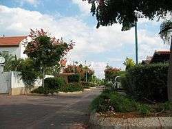
Kadima-Zoran (Hebrew: קדימה-צורן), also known as Kadima-Tzoran, is a local council in the Central District of Israel. The result of the 2003 union of the Tzoran and Kadima councils, in 2017 it had a population of 21,987.[1]
Kadima-Zoran is home to the "Ta'am Shel Pa'am" (A Taste of Old) museum for the history of the settlement in the elementary school "Nitzanei HaSharon".
History
Kadima
Kadima was founded on 5 July 1933 as an agricultural settlement at the initiative of Yehoshua Hankin. Most of the settlers were German immigrants.[2] The name means "forward" in Hebrew, and was taken from a Biblical verse (Habakkuk 1:9).[2] The town was declared a local council in 1950.
Tzoran
Tzoran, meaning silicon, was founded in 1992 and was planned by architect Rachel Walden. The settlement was named after a Hasmonean city that had existed in the area. It was first populated in 1994, and declared a local council in 1997.
References
| Wikimedia Commons has media related to Tzoran-Kadima. |