Epsom, Minnesota
| Epsom, Minnesota | |
|---|---|
| Unincorporated community | |
 Epsom, Minnesota Location of the community of Epsom within Richland Township, Rice County  Epsom, Minnesota Epsom, Minnesota (the US) | |
| Coordinates: 44°15′44″N 93°03′22″W / 44.26222°N 93.05611°WCoordinates: 44°15′44″N 93°03′22″W / 44.26222°N 93.05611°W | |
| Country | United States |
| State | Minnesota |
| County | Rice County |
| Township | Richland Township |
| Elevation | 1,119 ft (341 m) |
| Time zone | UTC-6 (Central (CST)) |
| • Summer (DST) | UTC-5 (CDT) |
| ZIP code | 55946 |
| Area code(s) | 507 |
| GNIS feature ID | 654695[1] |
Epsom is an unincorporated community in Richland Township, Rice County, Minnesota, United States.
The community is located along Rice County Road 26 (Larson Avenue) near its junction with 230th Street East.
State Highway 60 (MN 60) is also in the immediate area. The North Fork of the Zumbro River flows through the community.
Nearby places include Kenyon, Nerstrand, Faribault, Ruskin, and Moland.
Epsom is located within ZIP code 55946 based in Kenyon. The boundary line between Rice and Goodhue counties is near Epsom.
References
Municipalities and communities of Rice County, Minnesota, United States | ||
|---|---|---|
| Cities | 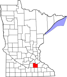 | |
| Townships | ||
| CDP | ||
| Unincorporated communities | ||
| Ghost towns/Neighborhoods | ||
| Footnotes | ‡This populated place also has portions in an adjacent county or counties | |
This article is issued from
Wikipedia.
The text is licensed under Creative Commons - Attribution - Sharealike.
Additional terms may apply for the media files.