Eijsden-Margraten
| Eijsden-Margraten | |||
|---|---|---|---|
| Municipality | |||
| |||
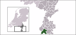 Location in Limburg | |||
| Coordinates: 50°47′N 5°42′E / 50.783°N 5.700°ECoordinates: 50°47′N 5°42′E / 50.783°N 5.700°E | |||
| Country |
| ||
| Province |
| ||
| Established | 1 January 2011[1] | ||
| Government[2] | |||
| • Body | Municipal council | ||
| • Mayor | Dieudonné Akkermans (CDA) | ||
| Area[3] | |||
| • Total | 78.32 km2 (30.24 sq mi) | ||
| • Land | 77.40 km2 (29.88 sq mi) | ||
| • Water | 0.92 km2 (0.36 sq mi) | ||
| Elevation[4] | 56 m (184 ft) | ||
| Population (August 2017)[5] | |||
| • Total | 25,517 | ||
| • Density | 330/km2 (900/sq mi) | ||
| Time zone | UTC+1 (CET) | ||
| • Summer (DST) | UTC+2 (CEST) | ||
| Postcode | 6245–6269, 6307 | ||
| Area code | 043 | ||
| Website |
www | ||


Eijsden-Margraten (![]()
![]()
This municipality was formed in 2011 from the former municipalities of Eijsden and Margraten, that both consisted of a number of separately situated villages. As a result, the nowadays Eijsden-Margraten municipality consists of 28 villages and townships, spread out over 15 administrative centres. As of 2011, it has a population of about 25,000.
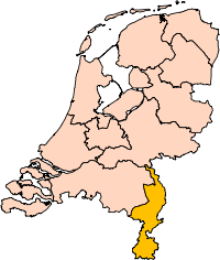
Eijsden-Margraten is one of the most southerly municipalities in the Netherlands, for in its south it is extending up to the most southerly part of the border between the Netherlands and Belgium.
The Meuse river, coming from France and Belgium, at Eijsden enters its third and final flowing country, the Netherlands. From here on its name in Dutch is "Maas". Running northward to Eijsden-Margraten's west it locally forms the westerly frontier of the last mentioned country with Belgium.
A smaller stream, the Voer, coming from Belgium, drains into the Meuse river in this municipality, after having passed through a few of its villages.
Population centres
|
|
|
|
Of them Eijsden, Gronsveld, Mariadorp, Mesch, Oost-Maarland and Rijckholt are former parts of the Eijsden municipality, whereas the others are former parts of the Margraten municipality.
.JPG) Fruit trees near Eijsden Castle |
 Land pastures on the hilly Margraten Plateau |
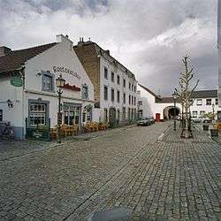 Part of the Eijsden "Vroenhof" central square |
Apart from Mesch all former Eijsden villages are situated in the valley of the Meuse river, whereas Mesch and the former Margraten villages are on a highland called the "Margraten Plateau".
Economy
Main aspects of economical activity in the for a long time agricultural villages of this municipality are:
- Fruit growing (apples, pears, prunes, cherries, strawberries).
- Grain growing (wheat, barley, corn)
- Cattle farming (milk cows, hen's eggs)
- Some industry (mainly at Eijsden)
- Tourism
Culture
Essential elements of culture in this municipality's villages are:
- Music (most places have their own brass-band and church chorus);
- Religion (predominantly Roman Catholic);
- Folklore (among others several citizen soldieries);
- Carnival;
- Sports, of which especially bicycle racing and soccer are most popular;
- Art
Sights
- Castles of Eijsden,[6] Gronsveld,[7] Mheer[8] and Rijckholt[9]
- An ancient windmill at Bemelen[10] and five ancient water mills on the Voer river.[11]
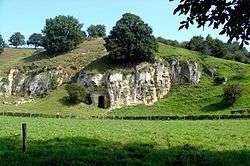
- Prehistoric flint mines at Rijckholt[12][13]
- The Mergellandroute, a tourist route through South Limburg, passes through several places in this municipality.
Persons
- Jean Bessems (Cadier en Keer), biljards; worldchampion artistic in 1985 and 1988.
- Eugene Dubois (1858–1940), (Eijsden), anthropology.
- Pierre Lardinois (1924–1987), (Noorbeek), politics
- Jo Maas, (Eijsden), cyclism
- Fons van Wissen, (Margraten), soccer (30 caps)
Miscellaneous
Gallery
.JPG) Meuse river entering The Netherlands at Eijsden |
 Marl of the Bemelerberg (Bemelen mountain) showing |
 Monumental half-timbered house at Banholt |
 Gronsveld castle |
Blankenberg castle at Cadier en Keer |
 Netherlands American Cemetery and Memorial at Margraten |
References

.
- ↑ "Gemeentelijke indeling op 1 januari 2011" [Municipal divisions on 1 January 2011]. cbs.nl (in Dutch). CBS. Retrieved 30 July 2013.
- ↑ "College van B&W" [Council of mayor and aldermen] (in Dutch). Gemeente Eijsden-Margraten. Retrieved 30 July 2013.
- ↑ "Kerncijfers wijken en buurten" [Key figures for neighbourhoods]. CBS Statline (in Dutch). CBS. 2 July 2013. Retrieved 12 March 2014.
- ↑ "Postcodetool for 6245EH". Actueel Hoogtebestand Nederland (in Dutch). Het Waterschapshuis. Retrieved 30 July 2013.
- ↑ "Bevolkingsontwikkeling; regio per maand" [Population growth; regions per month]. CBS Statline (in Dutch). CBS. 27 October 2017. Retrieved 27 October 2017.
- ↑ Eijsden castle at WpNl
- ↑ Gronsveld castle at WpNl
- ↑ Mheer castle at WpNl
- ↑ Rijckholt castle at WpNl
- ↑ Van Tienhovenmolen windmill at WpNl
- ↑ Image Eijsden watermill on WpCommons
- ↑ prehistoric flint mine at Rijckholt on WpCommons
- ↑ Rijckholt prehistoric flint mines on www.flintsource.net
- ↑ results WMC 2009 on NlWp
- ↑ Site of the World Music Contest
External links

- Official website (in Dutch)
- Most informative Wp-article on this subject (NlWp)
Places adjacent to Eijsden-Margraten | ||||||||||
|---|---|---|---|---|---|---|---|---|---|---|
| ||||||||||