Onderbanken
| Onderbanken Óngerbenk | |||
|---|---|---|---|
| Municipality | |||
 Church in Jabeek | |||
| |||
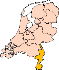
.svg.png) Location in Limburg | |||
| Coordinates: 50°58′N 5°59′E / 50.967°N 5.983°ECoordinates: 50°58′N 5°59′E / 50.967°N 5.983°E | |||
| Country | Netherlands | ||
| Province | Limburg | ||
| Established | 1 January 1982 | ||
| Government[1] | |||
| • Body | Municipal council | ||
| • Mayor | Odile Wolfs (acting) (PvdA) | ||
| Area[2] | |||
| • Total | 21.24 km2 (8.20 sq mi) | ||
| • Land | 21.18 km2 (8.18 sq mi) | ||
| • Water | 0.06 km2 (0.02 sq mi) | ||
| Elevation[3] | 68 m (223 ft) | ||
| Population (August 2017)[4] | |||
| • Total | 7,848 | ||
| • Density | 371/km2 (960/sq mi) | ||
| Time zone | UTC+1 (CET) | ||
| • Summer (DST) | UTC+2 (CEST) | ||
| Postcode | 6447–6456 | ||
| Area code | 045, 046 | ||
| Website |
www | ||

Onderbanken (Dutch pronunciation: [ˈɔndərˌbɑŋkə(n)] (![]()
Population centres
Bingelrade, Douvergenhout, Etzenrade, Jabeek, Merkelbeek, Op den Hering, Quabeek, Raath, Schinveld, Viel.
Topography
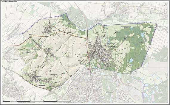
Dutch Topographic map of the municipality of Onderbanken, June 2015.
References
- ↑ "Burgemeester en wethouders" [Mayor and aldermen] (in Dutch). Gemeente Onderbanken. Retrieved 17 November 2013.
- ↑ "Kerncijfers wijken en buurten" [Key figures for neighbourhoods]. CBS Statline (in Dutch). CBS. 2 July 2013. Retrieved 12 March 2014.
- ↑ "Postcodetool for 6451EN". Actueel Hoogtebestand Nederland (in Dutch). Het Waterschapshuis. Retrieved 17 November 2013.
- ↑ "Bevolkingsontwikkeling; regio per maand" [Population growth; regions per month]. CBS Statline (in Dutch). CBS. 27 October 2017. Retrieved 27 October 2017.
External links

- Official website
This article is issued from
Wikipedia.
The text is licensed under Creative Commons - Attribution - Sharealike.
Additional terms may apply for the media files.