Doupě
| Doupě | |
|---|---|
| Municipality | |
 | |
 Doupě | |
| Coordinates: 49°14′40″N 15°25′42″E / 49.24444°N 15.42833°ECoordinates: 49°14′40″N 15°25′42″E / 49.24444°N 15.42833°E | |
| Country |
|
| Region | Vysočina |
| District | Jihlava |
| Area | |
| • Total | 5.12 km2 (1.98 sq mi) |
| Elevation | 593 m (1,946 ft) |
| Population (1.1.2013) | |
| • Total | 112 |
| • Density | 22/km2 (57/sq mi) |
| Postal code | 588 56 |
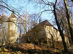
Doupě (Czech pronunciation: [ˈdou̯pjɛ]) is a village and municipality (obec) in Jihlava District in the Vysočina Region of the Czech Republic.
The municipality covers an area of 5.12 square kilometres (1.98 sq mi), and has a population of 106 (as at 3 July 2006).
Doupě lies approximately 21 kilometres (13 mi) south-west of Jihlava and 119 km (74 mi) south-east of Prague.
References
| Wikimedia Commons has media related to Doupě. |
This article is issued from
Wikipedia.
The text is licensed under Creative Commons - Attribution - Sharealike.
Additional terms may apply for the media files.