Don Victoriano Chiongbian, Misamis Occidental
| Don Victoriano Chiongbian | |
|---|---|
| Municipality | |
| Municipality of Don Victoriano Chiongbian | |
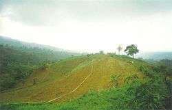 Mount Malindang | |
| Nickname(s): The Crossroads of MisOcc | |
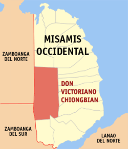 Map of Misamis Occidental with Don Victoriano Chiongbian highlighted | |
.svg.png) Don Victoriano Chiongbian Location within the Philippines | |
| Coordinates: 8°18′00″N 123°35′00″E / 8.3°N 123.5833°ECoordinates: 8°18′00″N 123°35′00″E / 8.3°N 123.5833°E | |
| Country |
|
| Region | Northern Mindanao (Region X) |
| Province | Misamis Occidental |
| District | 2nd District |
| Founded | February 8, 1982 |
| Named for | Victoriano Chiongbian |
| Barangays | 11 (see Barangays) |
| Government [1] | |
| • Type | Sangguniang Bayan |
| • Mayor | Rodolfo D. Luna |
| • Vice Mayor | Annabelle B. Hamoy |
| • Electorate | 5,359 voters (2016) |
| Area [2] | |
| • Total | 284.60 km2 (109.88 sq mi) |
| Population (2015 census)[3] | |
| • Total | 10,183 |
| • Density | 36/km2 (93/sq mi) |
| Time zone | UTC+8 (PST) |
| ZIP code | 7200 |
| PSGC | 104217000 |
| IDD : area code | +63 (0)88 |
| Climate type | Tropical climate |
| Income class | 4th municipal income class |
| Revenue (₱) | 72,867,152.27 (2016) |
| Native languages |
Subanon language Cebuano Tagalog |
| Website |
www |
Don Victoriano Chiongbian, officially the Municipality of Don Victoriano Chiongbian, is a 4th class municipality in the province of Misamis Occidental, Philippines. According to the 2015 census, it has a population of 10,183 people.[3]
It was created on February 8, 1982, as Don Mariano Marcos under virtue of Batas Pambansa Blg. 171. It was renamed in 1986 to its current name in honor of its first municipal mayor. The municipality is home to Mount Malindang National Park.
Barangays
Don Victoriano Chiongbian is politically subdivided into 11 barangays.
- Bagong Clarin
- Gandawan
- Lake Duminagat
- Lalud
- Lampasan
- Liboron
- Maramara
- Napangan
- Nueva Vista (Masawan)
- Petianan
- Tuno
Demographics
| Population census of Don Victoriano Chiongbian | ||
|---|---|---|
| Year | Pop. | ±% p.a. |
| 1990 | 5,803 | — |
| 1995 | 6,878 | +3.24% |
| 2000 | 9,319 | +6.73% |
| 2007 | 10,157 | +1.19% |
| 2010 | 9,774 | −1.39% |
| 2015 | 10,183 | +0.78% |
| Source: Philippine Statistics Authority[3] [4] [5] [6] | ||
In the 2015 census, the population of Don Victoriano Chiongbian was 10,183 people,[3] with a density of 36 inhabitants per square kilometre or 93 inhabitants per square mile.
References
- ↑ "Municipality". Quezon City, Philippines: Department of the Interior and Local Government. Retrieved 31 May 2013.
- ↑ "Province: Misamis Occidental". PSGC Interactive. Quezon City, Philippines: Philippine Statistics Authority. Retrieved 12 November 2016.
- 1 2 3 4 Census of Population (2015). "Region X (Northern Mindanao)". Total Population by Province, City, Municipality and Barangay. PSA. Retrieved 20 June 2016.
- ↑ Census of Population and Housing (2010). "Region X (Northern Mindanao)". Total Population by Province, City, Municipality and Barangay. NSO. Retrieved 29 June 2016.
- ↑ Censuses of Population (1903–2007). "Region X (Northern Mindanao)". Table 1. Population Enumerated in Various Censuses by Province/Highly Urbanized City: 1903 to 2007. NSO.
- ↑ "Province of Misamis Occidental". Municipality Population Data. Local Water Utilities Administration Research Division. Retrieved 17 December 2016.
External links
- Philippine Standard Geographic Code
- Philippine Census Information
- Local Governance Performance Management System
Places adjacent to Don Victoriano Chiongbian, Misamis Occidental | |
|---|---|
This article is issued from
Wikipedia.
The text is licensed under Creative Commons - Attribution - Sharealike.
Additional terms may apply for the media files.