Clarin, Misamis Occidental
| Clarin | |
|---|---|
| Municipality | |
| Municipality of Clarin | |
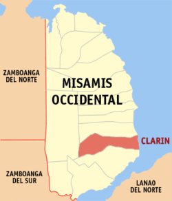 Map of Misamis Occidental with Clarin highlighted | |
.svg.png) Clarin Location within the Philippines | |
| Coordinates: 8°12′N 123°51′E / 8.2°N 123.85°ECoordinates: 8°12′N 123°51′E / 8.2°N 123.85°E | |
| Country |
|
| Region | Northern Mindanao (Region X) |
| Province | Misamis Occidental |
| District | 2nd District |
| Founded | February 21, 1921 |
| Barangays | 29 (see Barangays) |
| Government [1] | |
| • Type | Sangguniang Bayan |
| • Mayor | David M. Navarro |
| • Vice Mayor | Glory Fe D. Roa |
| • Electorate | 23,463 voters (2016) |
| Area [2] | |
| • Total | 84.50 km2 (32.63 sq mi) |
| Population (2015 census)[3] | |
| • Total | 37,548 |
| • Density | 440/km2 (1,200/sq mi) |
| Time zone | UTC+8 (PST) |
| ZIP code | 7201 |
| PSGC | 104205000 |
| IDD : area code | +63 (0)88 |
| Climate type | Tropical climate |
| Income class | 4th municipal income class |
| Revenue (₱) | 110,207,933.30 (2016) |
| Native languages |
Subanon language Cebuano Tagalog |
Clarin, officially the Municipality of Clarin, is a 4th class municipality in the province of Misamis Occidental, Philippines. According to the 2015 census, it has a population of 37,548 people.[3]
Barangays
Clarin is politically subdivided into 29 barangays.
- Bernad
- Bito-on
- Cabunga-an
- Canibungan Daku
- Canibungan Putol
- Canipacan
- Dalingap
- Dela Paz
- Dolores
- Gata Daku
- Gata Diot
- Guba (Ozamis)
- Kinangay Norte
- Kinangay Sur
- Lapasan
- Lupagan
- Malibangcao
- Masabud
- Mialen
- Pan-ay
- Penacio
- Poblacion I
- Poblacion II
- Poblacion III
- Poblacion IV
- Segatic Daku
- Segatic Diot
- Sebasi
- Tinacla-an
Demographics
| Population census of Clarin | |||||||||||||||||||||||||||||||||||||||||||
|---|---|---|---|---|---|---|---|---|---|---|---|---|---|---|---|---|---|---|---|---|---|---|---|---|---|---|---|---|---|---|---|---|---|---|---|---|---|---|---|---|---|---|---|
|
| ||||||||||||||||||||||||||||||||||||||||||
| Source: Philippine Statistics Authority[3] [4] [5] [6] | |||||||||||||||||||||||||||||||||||||||||||
In the 2015 census, the population of Clarin, Misamis Occidental, was 37,548 people,[3] with a density of 440 inhabitants per square kilometre or 1,100 inhabitants per square mile.
Economy
Most of the town's people earned their living through farming and fishing. Farming involves many rice fields that had been cultivated for the past years. Fishing provides both a lot of fishes and sea shells that were hiding in the deep areas of Panguil Bay.
References
- ↑ "Municipality". Quezon City, Philippines: Department of the Interior and Local Government. Retrieved 31 May 2013.
- ↑ "Province: Misamis Occidental". PSGC Interactive. Quezon City, Philippines: Philippine Statistics Authority. Retrieved 12 November 2016.
- 1 2 3 4 Census of Population (2015). "Region X (Northern Mindanao)". Total Population by Province, City, Municipality and Barangay. PSA. Retrieved 20 June 2016.
- ↑ Census of Population and Housing (2010). "Region X (Northern Mindanao)". Total Population by Province, City, Municipality and Barangay. NSO. Retrieved 29 June 2016.
- ↑ Censuses of Population (1903–2007). "Region X (Northern Mindanao)". Table 1. Population Enumerated in Various Censuses by Province/Highly Urbanized City: 1903 to 2007. NSO.
- ↑ "Province of Misamis Occidental". Municipality Population Data. Local Water Utilities Administration Research Division. Retrieved 17 December 2016.
External links
- Philippine Standard Geographic Code
- Philippine Census Information
- Local Governance Performance Management System
Places adjacent to Clarin, Misamis Occidental | ||||||||||
|---|---|---|---|---|---|---|---|---|---|---|
| ||||||||||
This article is issued from
Wikipedia.
The text is licensed under Creative Commons - Attribution - Sharealike.
Additional terms may apply for the media files.