Concepcion, Misamis Occidental
| Concepcion | |
|---|---|
| Municipality | |
| Municipality of Concepcion | |
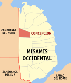 Map of Misamis Occidental with Concepcion highlighted | |
.svg.png) Concepcion Location within the Philippines | |
| Coordinates: 8°25′00″N 123°36′00″E / 8.4166667°N 123.6°ECoordinates: 8°25′00″N 123°36′00″E / 8.4166667°N 123.6°E | |
| Country |
|
| Region | Northern Mindanao (Region X) |
| Province | Misamis Occidental |
| District | 1st District |
| Founded | September 21, 1956 |
| Barangays | 18 (see Barangays) |
| Government [1] | |
| • Type | Sangguniang Bayan |
| • Mayor | Juanidy Malandiay Viña |
| • Vice Mayor | Ruben M. Omandam |
| • Electorate | 3,605 voters (2016) |
| Area [2] | |
| • Total | 61.60 km2 (23.78 sq mi) |
| Population (2015 census)[3] | |
| • Total | 10,937 |
| • Density | 180/km2 (460/sq mi) |
| Time zone | UTC+8 (PST) |
| ZIP code | 7213 |
| PSGC | 104206000 |
| IDD : area code | +63 (0)88 |
| Climate type | Tropical climate |
| Income class | 6th municipal income class |
| Revenue (₱) | 42,463,610.37 (2016) |
| Native languages |
Subanon language Cebuano Tagalog |
| Website |
www |
Concepcion, officially the Municipality of Concepcion, is a 6th class municipality in the province of Misamis Occidental, Philippines. According to the 2015 census, it has a population of 10,937 people.[3]
It is considered as a suburb to the provincial capital Oroquieta.
Barangays
Concepcion is politically subdivided into 18 barangays.
- Bagong Nayon
- Capule
- New Casul
- Guiban
- Laya-an
- Lingatongan
- Maligubaan
- Mantukoy
- Marugang
- Poblacion
- Pogan
- Small Potongan
- Soso-on
- Upper Dapitan
- Upper Dioyo
- Upper Potongan
- Upper Salimpono
- Virayan
Demographics
| Population census of Concepcion | |||||||||||||||||||||||||||||||||||||
|---|---|---|---|---|---|---|---|---|---|---|---|---|---|---|---|---|---|---|---|---|---|---|---|---|---|---|---|---|---|---|---|---|---|---|---|---|---|
|
| ||||||||||||||||||||||||||||||||||||
| Source: Philippine Statistics Authority[3] [4] [5] [6] | |||||||||||||||||||||||||||||||||||||
In the 2015 census, the population of Concepcion, Misamis Occidental, was 10,937 people,[3] with a density of 180 inhabitants per square kilometre or 470 inhabitants per square mile.
References
- ↑ "Municipality". Quezon City, Philippines: Department of the Interior and Local Government. Retrieved 31 May 2013.
- ↑ "Province: Misamis Occidental". PSGC Interactive. Quezon City, Philippines: Philippine Statistics Authority. Retrieved 12 November 2016.
- 1 2 3 4 Census of Population (2015). "Region X (Northern Mindanao)". Total Population by Province, City, Municipality and Barangay. PSA. Retrieved 20 June 2016.
- ↑ Census of Population and Housing (2010). "Region X (Northern Mindanao)". Total Population by Province, City, Municipality and Barangay. NSO. Retrieved 29 June 2016.
- ↑ Censuses of Population (1903–2007). "Region X (Northern Mindanao)". Table 1. Population Enumerated in Various Censuses by Province/Highly Urbanized City: 1903 to 2007. NSO.
- ↑ "Province of Misamis Occidental". Municipality Population Data. Local Water Utilities Administration Research Division. Retrieved 17 December 2016.
External links
- Philippine Standard Geographic Code
- Philippine Census Information
- Local Governance Performance Management System
Places adjacent to Concepcion, Misamis Occidental | |
|---|---|
This article is issued from
Wikipedia.
The text is licensed under Creative Commons - Attribution - Sharealike.
Additional terms may apply for the media files.