Calamba, Misamis Occidental
| Calamba | ||
|---|---|---|
| Municipality | ||
| Municipality of Calamba | ||
| ||
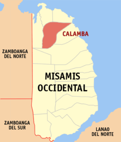 Map of Misamis Occidental with Calamba highlighted | ||
.svg.png) Calamba Location within the Philippines | ||
| Coordinates: 8°33′30″N 123°38′30″E / 8.5583333°N 123.6416667°ECoordinates: 8°33′30″N 123°38′30″E / 8.5583333°N 123.6416667°E | ||
| Country |
| |
| Region | Northern Mindanao (Region X) | |
| Province | Misamis Occidental | |
| District | 1st district of Misamis Occidental | |
| Founded | February 14, 1948 | |
| Barangays | 19 (see Barangays) | |
| Government [1] | ||
| • Type | Sangguniang Bayan | |
| • Mayor | Ezel T. Villanueva | |
| • Vice Mayor | Antonio N. Lawas | |
| • Electorate | 13,686 voters (2016) | |
| Area [2] | ||
| • Total | 104.64 km2 (40.40 sq mi) | |
| Population (2015 census)[3] | ||
| • Total | 21,676 | |
| • Density | 210/km2 (540/sq mi) | |
| Time zone | UTC+8 (PST) | |
| ZIP code | 7210 | |
| PSGC | 104204000 | |
| IDD : area code | +63 (0)88 | |
| Climate type | Tropical climate | |
| Income class | 4th municipal income class | |
| Revenue (₱) | 90,693,008.99 (2016) | |
| Native languages |
Subanon language Cebuano Tagalog | |
| Website |
www | |

Calamba, officially the Municipality of Calamba, is a 4th class municipality in the province of Misamis Occidental, Philippines. According to the 2015 census, it has a population of 21,676 people.[3]
Barangays
Calamba is politically subdivided into 19 barangays.
- Bonifacio
- Bunawan
- Calaran
- Dapacan Alto
- Dapacan Bajo
- Langub
- Libertad
- Magcamiguing
- Mamalad
- Mauswagon
- Northern Poblacion
- Salvador
- San Isidro
- Siloy
- Singalat
- Solinog
- Southwestern Poblacion
- Sulipat
- Don Bernardo Neri Pob
Demographics
| Population census of Calamba | ||||||||||||||||||||||||||||||||||||||||
|---|---|---|---|---|---|---|---|---|---|---|---|---|---|---|---|---|---|---|---|---|---|---|---|---|---|---|---|---|---|---|---|---|---|---|---|---|---|---|---|---|
|
| |||||||||||||||||||||||||||||||||||||||
| Source: Philippine Statistics Authority[3] [4] [5] [6] | ||||||||||||||||||||||||||||||||||||||||
In the 2015 census, the population of Calamba, Misamis Occidental, was 21,676 people,[3] with a density of 210 inhabitants per square kilometre or 540 inhabitants per square mile.
Schools
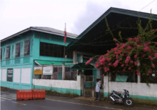
The Liberation Institute, Calamba
- Calamba Central School
- Calamba National Comprehensive High School
- Liberation Institute
- Sacred Heart College
- CCIT or College of Communication, Information & Technology
- MCC
- Jansen Computer Institute
References
- ↑ "Municipality". Quezon City, Philippines: Department of the Interior and Local Government. Retrieved 31 May 2013.
- ↑ "Province: Misamis Occidental". PSGC Interactive. Quezon City, Philippines: Philippine Statistics Authority. Retrieved 12 November 2016.
- 1 2 3 4 Census of Population (2015). "Region X (Northern Mindanao)". Total Population by Province, City, Municipality and Barangay. PSA. Retrieved 20 June 2016.
- ↑ Census of Population and Housing (2010). "Region X (Northern Mindanao)". Total Population by Province, City, Municipality and Barangay. NSO. Retrieved 29 June 2016.
- ↑ Censuses of Population (1903–2007). "Region X (Northern Mindanao)". Table 1. Population Enumerated in Various Censuses by Province/Highly Urbanized City: 1903 to 2007. NSO.
- ↑ "Province of Misamis Occidental". Municipality Population Data. Local Water Utilities Administration Research Division. Retrieved 17 December 2016.
External links
- Philippine Standard Geographic Code
- Philippine Census Information
- Local Governance Performance Management System
Places adjacent to Calamba, Misamis Occidental | ||||||||||
|---|---|---|---|---|---|---|---|---|---|---|
| ||||||||||
This article is issued from
Wikipedia.
The text is licensed under Creative Commons - Attribution - Sharealike.
Additional terms may apply for the media files.