Dolní Kounice
| Dolní Kounice | |||
| Town | |||
 | |||
|
|||
| Country | Czech Republic | ||
|---|---|---|---|
| Region | South Moravian | ||
| District | Brno-venkov | ||
| Commune | Ivančice | ||
| River | Jihlava River | ||
| Elevation | 195 m (640 ft) | ||
| Coordinates | 49°4′12.41″N 16°27′53.71″E / 49.0701139°N 16.4649194°ECoordinates: 49°4′12.41″N 16°27′53.71″E / 49.0701139°N 16.4649194°E | ||
| Area | 8.97 km2 (3.46 sq mi) | ||
| Population | 2,454 (2012) | ||
| Density | 274/km2 (710/sq mi) | ||
| Mayor | Radka Formánková | ||
| Timezone | CET (UTC+1) | ||
| - summer (DST) | CEST (UTC+2) | ||
| Postal code | 664 64 | ||
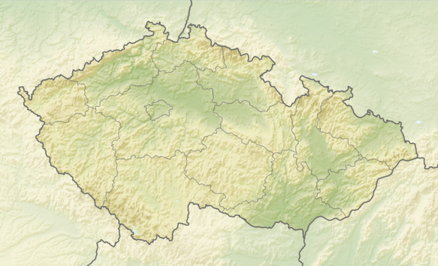 Location in the Czech Republic | |||
| Wikimedia Commons: Dolní Kounice | |||
| Statistics: statnisprava.cz | |||
| Website: www.dolnikounice.cz | |||

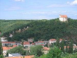
Dolní Kounice (Czech pronunciation: [ˈdolɲiː ˈkouɲɪtsɛ]; German: Kanitz) is a small town in the South Moravian Region of the Czech Republic. It has around 2,400 inhabitants.
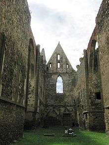
The ancient town of Dolní Kounice is situated about 25 km south from Brno in the valley of the Jihlava river. In the town you can find plenty of monuments from different periods – the chapel of St. Anthony, romantic ruins of the convent Rosa coeli, the castle, the Dolní Kounice Synagogue and Jewish cemetery, other churches and chapels, renaissance and baroque houses, columns with crucifixion and Marian columns standing by the roadsides. Orchards and vineyards where the famous “frankovka” is grown increase the attractiveness of this town.

External links

- Municipal website (in Czech)
This article is issued from
Wikipedia.
The text is licensed under Creative Commons - Attribution - Sharealike.
Additional terms may apply for the media files.