Dodd Road Discontiguous District
|
Dodd Road Discontiguous District | |
 | |
 | |
| Nearest city | Forest, Minnesota |
|---|---|
| Coordinates | 44°19′39″N 93°37′47″W / 44.327548°N 93.629823°WCoordinates: 44°19′39″N 93°37′47″W / 44.327548°N 93.629823°W |
| Area | 104 acres (42 ha) |
| Built | 1853 |
| Built by | William B. Dodd |
| NRHP reference # | 03000520[1] |
| Added to NRHP | June 12, 2003 |
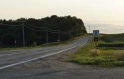
Dodd Road Discontiguous District near Forest, Minnesota is a set of three road segments which were listed on the National Register of Historic Places in 2003. They preserve segments of Dodd Road, a private road built by William B. Dodd. It was a privately funded road built between Mendota and St. Peter in 1853, and was a key transportation artery in early south-central Minnesota.[2][3]
The listing includes three contributing structures on 104 acres (42 ha).[1]
In Le Sueur County, Minnesota, it includes two segments: County Road 148 west of Cleveland, and County Road 136 from MN 13 to Cordova. These are in the vicinities of Cleveland and Kilkenny.
In Rice County, Minnesota, it includes former County Road 61 (Circle Lake Trail, Falls Trail, Garfield Avenue, and Groveland Trail) between Millersburg and Shieldsville. This is a 6.8-mile (10.9 km) segment.[2]
References
- 1 2 National Park Service (2013-11-02). "National Register Information System". National Register of Historic Places. National Park Service.
- 1 2 Godfrey, Anthony (2002-09-30). "National Register of Historic Places Registration Form: Dodd Road" (PDF). National Park Service. Retrieved 2013-08-21.
- ↑ Anthony Godfrey (September 30, 2002). "National Register of Historic Places Registration: Dodd Road Discontiguous District". National Park Service. Retrieved June 10, 2018. With accompanying five photos from 2002
| Topics | |
|---|---|
| Lists by states |
|
| Lists by insular areas | |
| Lists by associated states | |
| Other areas | |
| |