Diplahan, Zamboanga Sibugay
| Diplahan | |
|---|---|
| Municipality | |
| Municipality of Diplahan | |
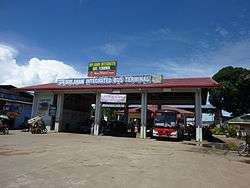 Integrated Bus Terminal | |
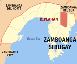 Map of Zamboanga Sibugay with Diplahan highlighted | |
.svg.png) Diplahan Location within the Philippines | |
| Coordinates: 7°43′N 123°01′E / 7.72°N 123.02°ECoordinates: 7°43′N 123°01′E / 7.72°N 123.02°E | |
| Country |
|
| Region | Zamboanga Peninsula (Region IX) |
| Province | Zamboanga Sibugay |
| District | 1st District |
| Barangays | 22 (see Barangays) |
| Government [1] | |
| • Type | Sangguniang Bayan |
| • Mayor | Lycel Castor-Tan |
| • Electorate | 18,379 voters (2016) |
| Area [2] | |
| • Total | 255.51 km2 (98.65 sq mi) |
| Population (2015 census)[3] | |
| • Total | 32,428 |
| • Density | 130/km2 (330/sq mi) |
| Time zone | UTC+8 (PST) |
| ZIP code | 7039 |
| PSGC | 098303000 |
| IDD : area code | +63 (0)62 |
| Climate type | Tropical climate |
| Income class | 3rd municipal income class |
| Revenue (₱) | 133,797,900.75 (2016) |
| Native languages |
Subanon language Cebuano Chavacano Tagalog |
Diplahan, officially the Municipality of Diplahan, is a 3rd class municipality in the province of Zamboanga Sibugay, Philippines. According to the 2015 census, it has a population of 32,428 people.[3]
Barangays
Diplahan is politically subdivided into 22 barangays.
- Balangao
- Butong
- Ditay
- Gaulan
- Goling
- Guinoman
- Kauswagan
- Lindang
- Lobing
- Luop
- Manangon
- Mejo
- Natan
- Paradise
- Pilar
- Poblacion (Diplahan)
- Sampoli A
- Sampoli B
- Santa Cruz
- Songcuya
- Tinongtongan
- Tuno
Demographics
| Population census of Diplahan | ||
|---|---|---|
| Year | Pop. | ±% p.a. |
| 1980 | 15,899 | — |
| 1990 | 21,221 | +2.93% |
| 1995 | 25,818 | +3.74% |
| 2000 | 23,909 | −1.63% |
| 2007 | 28,010 | +2.21% |
| 2010 | 31,215 | +4.02% |
| 2015 | 32,428 | +0.73% |
| Source: Philippine Statistics Authority[3] [4] [5] [6] | ||
References
- ↑ "Municipality". Quezon City, Philippines: Department of the Interior and Local Government. Retrieved 31 May 2013.
- ↑ "Province: Zamboanga Sibugay". PSGC Interactive. Quezon City, Philippines: Philippine Statistics Authority. Retrieved 12 November 2016.
- 1 2 3 Census of Population (2015). "Region IX (Zamboanga Peninsula)". Total Population by Province, City, Municipality and Barangay. PSA. Retrieved 20 June 2016.
- ↑ Census of Population and Housing (2010). "Region IX (Zamboanga Peninsula)". Total Population by Province, City, Municipality and Barangay. NSO. Retrieved 29 June 2016.
- ↑ Censuses of Population (1903–2007). "Region IX (Zamboanga Peninsula)". Table 1. Population Enumerated in Various Censuses by Province/Highly Urbanized City: 1903 to 2007. NSO.
- ↑ "Province of Zamboanga Sibugay". Municipality Population Data. Local Water Utilities Administration Research Division. Retrieved 17 December 2016.
External links

- Philippine Standard Geographic Code
Places adjacent to Diplahan, Zamboanga Sibugay | ||||||||||
|---|---|---|---|---|---|---|---|---|---|---|
| ||||||||||
Ipil (capital) | |
| Municipalities | |
This article is issued from
Wikipedia.
The text is licensed under Creative Commons - Attribution - Sharealike.
Additional terms may apply for the media files.