Currawang
| Currawang New South Wales | |||||||||||||||
|---|---|---|---|---|---|---|---|---|---|---|---|---|---|---|---|
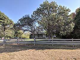 House in Currawang | |||||||||||||||
|
Currawang Location in New South Wales | |||||||||||||||
| Coordinates | 34°57′57″S 149°31′02″E / 34.96583°S 149.51722°ECoordinates: 34°57′57″S 149°31′02″E / 34.96583°S 149.51722°E | ||||||||||||||
| Population | 182 (2016 census)[1] | ||||||||||||||
| Postcode(s) | 2580 | ||||||||||||||
| Location | |||||||||||||||
| LGA(s) | |||||||||||||||
| Region | Southern Tablelands | ||||||||||||||
| County | Argyle | ||||||||||||||
| Parish | Currawang | ||||||||||||||
| State electorate(s) | Monaro | ||||||||||||||
| Federal Division(s) | Eden-Monaro | ||||||||||||||
| |||||||||||||||
Currawang is a locality in the Queanbeyan–Palerang Regional Council, on the edges of Upper Lachlan Shire and Goulburn-Mulwaree Council, in New South Wales, Australia. It is located to the north of Lake George.[2] It shares its name with the Currawang Parish of Argyle County, in which it is located. This was formerly known as the parish of Currowang. Both names derive from an Aboriginal word for the spearwood tree (Acacia doratoxylon).[3][4]
History
The area of Currawang was first inhabited by the Gundungurra people, who called the area Werriwa, and who were apparently badly affected by influenza in 1846/47.
In the mid 1840s the NSW colonial government granted numerous land grants in area, beginning white settlement.
Copper was soon discovered,[5] as was gold, 7km to the west, and a town of Currawang soon sprung up.[6] The town had a post office, shops, primary school and two churches. The post office operated from 1866 and which was closed on 31 March 1962 while the Currawang Public School operated from 1870 till 1944. The mines closed in the 1990s and today only the Catholic (Hermitage) and Protestant (St. Matthias) church buildings remain.
Currawang Today
Pastoralism remains the dominant part of the economy, however employment also comes from the waste management facilities reusing the former mine sites, and the recently constructed Capital Wind Farm. There is still an active Rural Fire Service Brigade.
Images
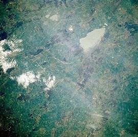 Lake George from space, November 1985
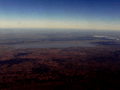 August 2010, aerial view looking northwest over the wind farm.
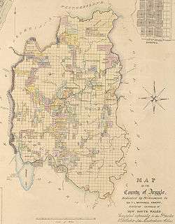 1840s map of the County of Argyle
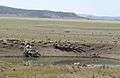 Currowang in the distance
Notable residents
References
- ↑ Australian Bureau of Statistics (27 June 2017). "Currawang". 2016 Census QuickStats. Retrieved 28 July 2017.

- ↑ "Currawang". Geographical Names Register (GNR) of NSW. Geographical Names Board of New South Wales. Retrieved 28 July 2017.
- ↑ "Currawang". Geographical Names Register (GNR) of NSW. Geographical Names Board of New South Wales. Retrieved 28 July 2017.
- ↑ "Currowang". Geographical Names Register (GNR) of NSW. Geographical Names Board of New South Wales. Retrieved 28 July 2017.
- ↑ McGOWAN, Barry. "A Social History of Currawang 1865-1885." Canberra Historical Journal. NS, No.32, September 1993.
- ↑ BARRY McGOWAN, Hegemony, localism and ethnicity: The "Welsh" mining communities of Currawang and Frogmore in southern New South Wales. Journal of Australasian Mining History Volume 5 September 2007.