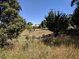
Harolds Cross, New South Wales
| Harolds Cross New South Wales | |||||||||||||||
|---|---|---|---|---|---|---|---|---|---|---|---|---|---|---|---|
 | |||||||||||||||
|
Harolds Cross Location in New South Wales | |||||||||||||||
| Coordinates | 35°34′35″S 149°33′29″E / 35.57639°S 149.55806°ECoordinates: 35°34′35″S 149°33′29″E / 35.57639°S 149.55806°E | ||||||||||||||
| Population | 53 (2016 census)[1] | ||||||||||||||
| Postcode(s) | 2622 | ||||||||||||||
| Location |
| ||||||||||||||
| LGA(s) | Queanbeyan-Palerang Regional Council | ||||||||||||||
| Region | Southern Tablelands | ||||||||||||||
| County | Murray | ||||||||||||||
| Parish | Jinero | ||||||||||||||
| State electorate(s) | Monaro | ||||||||||||||
| Federal Division(s) | Eden-Monaro | ||||||||||||||
| |||||||||||||||
Harolds Cross is a locality in the Queanbeyan–Palerang Regional Council, New South Wales, Australia. It is located about 11 km northeast of Captains Flat and 35 km southwest of Braidwood.[2][3] At the 2016 census, it had a population of 53.[1] It had a "half-time" school from 1868 and 1915; from 1949 to 1857, it operated as a "provisional school".[4]
References
- 1 2 Australian Bureau of Statistics (27 June 2017). "Harolds Cross". 2016 Census QuickStats. Retrieved 18 January 2018.

- ↑ "Harolds Cross". Geographical Names Register (GNR) of NSW. Geographical Names Board of New South Wales. Retrieved 18 January 2018.
- ↑ "Harolds Cross". OpenStreetMap. Retrieved 18 January 2018.
- ↑ "Harolds Cross Half-Time School in the School history database search". New South Wales Department of Education. Retrieved 19 January 2018.
This article is issued from
Wikipedia.
The text is licensed under Creative Commons - Attribution - Sharealike.
Additional terms may apply for the media files.