Northangera
| Northangera New South Wales | |||||||||||||||
|---|---|---|---|---|---|---|---|---|---|---|---|---|---|---|---|
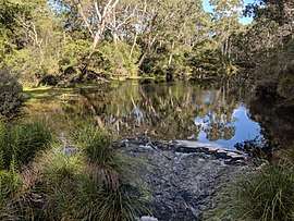 Mongarlowe river at Northangera | |||||||||||||||
|
Northangera Location in New South Wales | |||||||||||||||
| Coordinates | 35°27′40″S 149°54′36″E / 35.46111°S 149.91000°ECoordinates: 35°27′40″S 149°54′36″E / 35.46111°S 149.91000°E | ||||||||||||||
| Population | 43 (2016 census)[1] | ||||||||||||||
| Postcode(s) | 2622 | ||||||||||||||
| Location | |||||||||||||||
| LGA(s) | Queanbeyan-Palerang Regional Council | ||||||||||||||
| Region | Southern Tablelands | ||||||||||||||
| County | St Vincent | ||||||||||||||
| Parish | Budawang | ||||||||||||||
| State electorate(s) | Monaro | ||||||||||||||
| Federal Division(s) | Eden-Monaro | ||||||||||||||
| |||||||||||||||
Northangera is a locality in the Queanbeyan-Palerang Region, Southern Tablelands, New South Wales, Australia.[2][3] It lies on the Kings Highway about 100 km east of Canberra and 15 km east of Braidwood. At the 2016 census, it had a population of 43.[1] It had a "half-time" School from 1921 to 1931.[4] The name Northangera was assigned on 13 July 2001.==References==
- 1 2 Australian Bureau of Statistics (27 June 2017). "Northangera". 2016 Census QuickStats. Retrieved 14 March 2018.

- ↑ "Northangera". Geographical Names Register (GNR) of NSW. Geographical Names Board of New South Wales. Retrieved 14 March 2018.
- ↑ "Northangera". OpenStreetMap. Retrieved 14 March 2018.
- ↑ "Northangera Half-Time School in the School history database search". New South Wales Department of Education. Retrieved 14 March 2018.
This article is issued from
Wikipedia.
The text is licensed under Creative Commons - Attribution - Sharealike.
Additional terms may apply for the media files.