Marlowe, New South Wales
| Marlowe New South Wales | |||||||||||||||
|---|---|---|---|---|---|---|---|---|---|---|---|---|---|---|---|
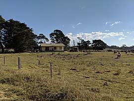 House in Charleyong or Marlowe | |||||||||||||||
|
Marlowe Location in New South Wales | |||||||||||||||
| Coordinates | 35°17′57″S 149°53′02″E / 35.29917°S 149.88389°ECoordinates: 35°17′57″S 149°53′02″E / 35.29917°S 149.88389°E | ||||||||||||||
| Population | 0 (2016 census)[1] | ||||||||||||||
| Postcode(s) | 2622 | ||||||||||||||
| Location | |||||||||||||||
| LGA(s) | Queanbeyan-Palerang Regional Council | ||||||||||||||
| Region | Southern Tablelands | ||||||||||||||
| County | St Vincent | ||||||||||||||
| Parish | Marlowe | ||||||||||||||
| State electorate(s) | Monaro | ||||||||||||||
| Federal Division(s) | Eden-Monaro | ||||||||||||||
| |||||||||||||||
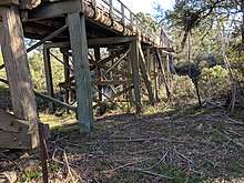
Marlowe is a locality in the Queanbeyan–Palerang Regional Council, New South Wales, Australia. It is located on the south side of the Mongarlowe River on the road from Braidwood to Nowra about 24 km north of Braidwood and 96 km soiuthwest of Nowra.[2][3] At the 2016 census, The Australian Bureau of Statistics recorded it as having a population of nil,[1] although it does have at least one house. It consists mainly of forest and grazing country. Marlowe includes the "rural place" of Charleyong in a loop of the Mongarlowe River at 35°14′57″S 149°55′02″E / 35.24917°S 149.91722°E.[4]
Marlowe had a state school from 1869 to 1906, from 1910 to 1931 and from 1935 to 1940, variously described as "provisional", "half-time" or "public". Up to June 1893 it was called Charleyong school and subsequently Marlow (sic) school.[5] There was another half-time school at Charleyong in 1928 and from 1930 to 1940.[6]
References
- 1 2 Australian Bureau of Statistics (27 June 2017). "Marlowe". 2016 Census QuickStats. Retrieved 27 April 2018.

- ↑ "Marlowe". Geographical Names Register (GNR) of NSW. Geographical Names Board of New South Wales. Retrieved 27 April 2018.
- ↑ "Marlowe". OpenStreetMap. Retrieved 27 April 2018.
- ↑ "Charleyong". Geographical Names Register (GNR) of NSW. Geographical Names Board of New South Wales. Retrieved 27 April 2018.
- ↑ "Marlow in the School history database search". New South Wales Department of Education. Retrieved 27 April 2018.
- ↑ "Charleyong (2) in the School history database search". New South Wales Department of Education. Retrieved 27 April 2018.