Crank Halt railway station
| Crank Halt | |
|---|---|
| Location | |
| Place | Rainford |
| Area | St Helens |
| Coordinates | 53°28′54″N 2°45′13″W / 53.48160°N 2.75370°WCoordinates: 53°28′54″N 2°45′13″W / 53.48160°N 2.75370°W |
| Grid reference | SJ501987 |
| Operations | |
| Original company | St Helens Canal and Railway |
| Pre-grouping | London and North Western Railway |
| Post-grouping | London, Midland and Scottish Railway |
| Platforms | Two[1] |
| History | |
| 1 February 1858 | Opened as Crank |
| 9 September 1940 | Renamed Crank Halt |
| 18 June 1951 | Closed to passengers |
| 6 July 1964 | Closed to all traffic |
| Disused railway stations in the United Kingdom | |
|
Closed railway stations in Britain A B C D–F G H–J K–L M–O P–R S T–V W–Z | |
|
| |
Crank Halt was a railway station serving the village of Crank, Merseyside, England on the St Helens to Rainford Junction[2] then Ormskirk line.[3]
History
The station was named Crank railway station from its opening for passengers on 1 February 1858 until 9 September 1940 when it was renamed Crank Halt.[4]
The station was operated by the St Helens Railway, LNWR, the London Midland and Scottish Railway from 1923 and finally British Railways (London Midland Region) until it closed in 1951 for scheduled passenger services. However, the line remained open for goods services and for passenger excursions and diversions up until 1964.
Location and facilities

The station was located at the foot of the hill up to the village just east of the level crossing with the minor road from St Helens to Crank which later became the B5201. It had distinctive wooden buildings on each platform with curved overhanging roofs[5][6] to provide protection from inclement weather. Some other stations on the line had buildings of the same pattern.
Services
In July 1922 thirteen "Up" (southbound) trains called at the station on weekdays, with an extra on Saturday evenings. All originated at Ormskirk, several with connections from Southport. Ten Up trains called on Sundays. All trains continued all stations to St Helens. The "Down" (northbound) service was similar.[7]
The trains all consisted of "Motor Cars – One class only". Please note that 'Motor Cars' then did not have their modern meaning, but consisted of a single railway coach joined to a dedicated steam locomotive. Their generic type is summarised in L&YR railmotors. Photographs appear in Bob Pixton's work on the line.[8]
In 1951 the Up service consisted of five trains on weekdays with three extra on Saturdays, all stations to St Helens. The rolling stock was "Third Class Only". No trains called on Sundays. The Down service was similar.
All local trains plying between Ormskirk and St Helens called at Rainford Junction, entailing a reverse. None used the 'direct line' between Bushey Lane Junction[9] and Randle Junction[10] which formed the third side of the triangle shown near the top of the route diagram. That stretch was the preserve of goods trains, diversions and occasional specials.[11]
Private sidings
Crank Colliery had its own private siding which left the line immediately south of the halt. The colliery company was wound up on 30 January 1880 and the colliery was dismantled. No trace can be seen in the 6" OS Map surveyed in 1892.[12]
| Preceding station | Disused railways | Following station | ||
|---|---|---|---|---|
| Moss Bank Line and station closed |
London and North Western Railway St Helens Canal and Railway |
Old Mill Lane Line and station closed | ||
References
- ↑ http://www.subbrit.org.uk/sb-sites/stations/c/crank/index.shtml
- ↑ ELR and mileages via railwaycodes.org.uk
- ↑ Smith & Turner 2012, Map 45
- ↑ Butt 1995, p. 70
- ↑ Fields, Gilbert & Knight 1995, Print 25
- ↑ Pixton 1996, p. 100
- ↑ Bradshaw 1922, p. 485
- ↑ Pixton 1996, pp. 87–90 & 101
- ↑ Pixton 1996, p. 92
- ↑ Pixton 1996, p. 98
- ↑ Pixton 1996, p. 102
- ↑ Townley & Peden 2002, p. 520
Sources
- Bradshaw, George (1985) [July 1922]. July 1922 Railway Guide. Newton Abbot: David and Charles. ISBN 978-0-7153-8708-5. OCLC 12500436.
- Butt, R. V. J. (1995). The Directory of Railway Stations: details every public and private passenger station, halt, platform and stopping place, past and present (1st ed.). Sparkford: Patrick Stephens Ltd. ISBN 978-1-85260-508-7. OCLC 60251199.
- Fields, N; Gilbert, A C; Knight, N R (1980), Liverpool to Manchester into the Second Century, Rochdale: Manchester Transport Museum Society, ISBN 978-0-900857-19-5
- Pixton, Bob (1996), The Archive Photographs Series Widnes and St Helens Railways, Stroud: The Chalford Publishing Company, ISBN 978-0-7524-0751-7
- Smith, Paul; Turner, Keith (2012), Railway Atlas Then and Now, Hersham: Ian Allan Publishing, ISBN 978-0-7110-3695-6
- Townley, C H A; Peden, J A (2002), Industrial Railways of St Helens, Widnes and Warrington, Part 2, Whitby: Industrial Railway Society, ISBN 978-1-901556-25-4
External links
- A detailed history Disused Stations UK
- The station on a 1888-1913 Overlay OS Map National Library of Scotland
- The station on an old O.S. Map npemaps
- The station and line overlain on many maps Rail Map Online
Closed railway stations in Merseyside | ||
|---|---|---|
| Birkenhead Railway | 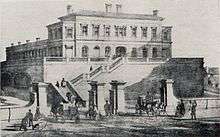 .JPG)   .jpg) | |
| Canada Dock Branch | ||
| Cheshire Lines Committee | ||
| Chester and Birkenhead Railway | ||
| Lancashire Union Railway | ||
| Liverpool and Manchester Railway | ||
| Liverpool, Crosby and Southport Railway | ||
| Liverpool Overhead Railway | ||
| Liverpool, Southport and Preston Junction Railway | ||
| Liverpool, St Helens and South Lancashire Railway | ||
| Manchester and Southport Railway | ||
| Mersey Docks and Harbour Board | ||
| North Mersey Branch | ||
| North Wales and Liverpool Railway | ||
| St Helens and Runcorn Gap Railway | ||
| West Lancashire Railway | ||
| Wirral Railway | ||
| Other | ||