Cotahuasi District
| Cotahuasi Kutawasi | |
|---|---|
| District | |
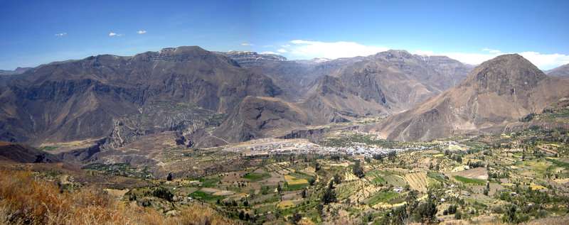 Cotahuasi canyon with the village of Cotahuasi and the mountain Wiñaw (on the right) as seen from the southwest | |
| Country |
|
| Region | Arequipa |
| Province | La Unión |
| Capital | Cotahuasi |
| Government | |
| • Mayor | Justo Pastor Totocayo Garate |
| Area | |
| • Total | 166.5 km2 (64.3 sq mi) |
| Elevation | 2,683 m (8,802 ft) |
| Population (2005 census) | |
| • Total | 2,974 |
| • Density | 18/km2 (46/sq mi) |
| Time zone | UTC-5 (PET) |
| UBIGEO | 040801 |
Cotahuasi District is one of eleven districts of the province La Unión in Peru.[1]
Cotahuasi is placed in the highest Andean place of Arequipa's department, in the Peruvian south. This province is characterized by its steep relief: cut here and as far back as rivers and gullies, with an altitud that different between the 1,000 and the 6,093 m.s.n.m., with 19 ecological floors. Its rural and isolated nature has made it so that its traditional customs and peoples have not gotten lost, such as has happened in neighboring provinces.
See also
References
- ↑ (in Spanish) Instituto Nacional de Estadística e Informática. Banco de Información Distrital Archived April 23, 2008, at the Wayback Machine.. Retrieved April 11, 2008.
This article is issued from
Wikipedia.
The text is licensed under Creative Commons - Attribution - Sharealike.
Additional terms may apply for the media files.