Pampamarca District, La Unión
| Pampamarca Pampa Marka | |
|---|---|
| District | |
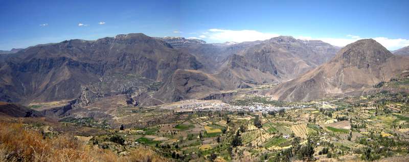 Pampamarka District (in the background) as seen from Cotahuasi | |
| Country |
|
| Region | Arequipa |
| Province | La Unión |
| Capital | Mungui |
| Government | |
| • Mayor | Lelis Enrique Ludeña Blas |
| Area | |
| • Total | 782.17 km2 (302.00 sq mi) |
| Elevation | 2,600 m (8,500 ft) |
| Population (2005 census) | |
| • Total | 1,831 |
| • Density | 2.3/km2 (6.1/sq mi) |
| Time zone | UTC-5 (PET) |
| UBIGEO | 040805 |
Pampamarca District is one of eleven districts of the La Unión Province in Peru.[1]
Geography
One of the highest peaks of the district is Lunq'u at 5,224 m (17,139 ft). Other mountains are listed below:[2]
- Anta P'unqu
- Aqu
- Ichhu Pata
- Illayuq
- Kimsa Qaqa
- Kunturillu
- Mach'ay P'unqu
- Pari Pari
- Paxsi
- Pilluni
- Qarwa K'uchu
- Qulluta
- Runtuyuq
- Sura Pata
- Tarujani
- T'uru Mach'ay
- Waman Allqa
- Wansu
- Waqutu
- Waylla Marka
- Waylla Sura
- Wilachiri
- Yana Qaqa
- Yana Sura
Ethnic groups
The people in the district are mainly indigenous citizens of Quechua descent. Quechua is the language which the majority of the population (80.11%) learnt to speak in childhood, 19.37% of the residents started speaking using the Spanish language (2007 Peru Census).[3]
References
- ↑ (in Spanish) Instituto Nacional de Estadística e Informática. Banco de Información Distrital Archived 2008-04-23 at the Wayback Machine.. Retrieved April 11, 2008.
- ↑ escale.minedu.gob.pe/ UGEL map La UniónProvince (Arequipa Region)
- ↑ inei.gob.pe Archived 2013-01-27 at the Wayback Machine. INEI, Peru, Censos Nacionales 2007, Frequencias: Preguntas de Población: Idioma o lengua con el que aprendió hablar (in Spanish)
This article is issued from
Wikipedia.
The text is licensed under Creative Commons - Attribution - Sharealike.
Additional terms may apply for the media files.