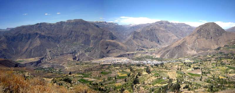
Cotahuasi Subbasin Landscape Reserve
| Cotahuasi Subbasin Landscape Reserve | |
|---|---|
| Reserva Paisajística Sub Cuenca del Cotahuasi | |
 | |
 Map of Peru | |
| Location | Arequipa Region, La Unión Province, Peru |
| Coordinates | 15°03′04″S 72°55′12″W / 15.051°S 72.92°W[1]Coordinates: 15°03′04″S 72°55′12″W / 15.051°S 72.92°W[2] |
| Area | 4,306 km2 (1,663 sq mi) |
| Established | May 18, 2005 |
The Cotahuasi Subbasin Landscape Reserve (Spanish: Reserva Paisajística Sub Cuenca del Cotahuasi) is a protected area in Peru located in the Arequipa Region, La Unión Province. It protects part of the Central Andean puna and Sechura Desert ecoregions.[3]
References
- ↑ "Sub Cuenca del Cotahuasi Landscape Reserve". protectedplanet.net.
- ↑ "Sub Cuenca del Cotahuasi Landscape Reserve". protectedplanet.net.
- ↑ Olson, D. M, E. Dinerstein; et al. (2001). "Terrestrial Ecoregions of the World: A New Map of Life on Earth". BioScience. 51 (11): 933–938. doi:10.1641/0006-3568(2001)051[0933:TEOTWA]2.0.CO;2. Archived from the original on 2011-10-14.
See also
External links
This article is issued from
Wikipedia.
The text is licensed under Creative Commons - Attribution - Sharealike.
Additional terms may apply for the media files.