Unorganized South West Cochrane District
| Unorganized South West Cochrane District | |
|---|---|
| Unorganized area | |
| Cochrane, Unorganized, South West Part | |
 Unorganized South West Cochrane | |
| Coordinates: 48°22′N 80°36′W / 48.367°N 80.600°WCoordinates: 48°22′N 80°36′W / 48.367°N 80.600°W | |
| Country |
|
| Province |
|
| District | Cochrane |
| Government | |
| • Federal riding | Timmins—James Bay |
| • Prov. riding | Timmins—James Bay |
| Area[1] | |
| • Land | 553.71 km2 (213.79 sq mi) |
| Population (2011)[1] | |
| • Total | 0 |
| • Density | 0/km2 (0/sq mi) |
| Time zone | UTC-5 (EST) |
| • Summer (DST) | UTC-4 (EDT) |
| Area code(s) | 705 |
Unorganized South West Cochrane District is an unorganized area in the Canadian province of Ontario, encompassing the small portion of the Cochrane District, between Black River-Matheson and Timmins, which is not part of either municipality.[2]
The division had a population of zero in the Canada 2011 Census, and a land area of 553.71 square kilometres.[1]
Demographics
Population:[3]
- Population in 2011: 0
- Population in 2006: 0
- Population in 2001: 0
- Population in 1996: 2
- Population in 1991: 0
See also
References
- 1 2 3 "Cochrane, Unorganized, South West Part census profile". 2011 Census of Population. Statistics Canada. Retrieved 2012-02-10.
- ↑ GeoSearch 2006
- ↑ Statistics Canada: 1996, 2001, 2006 census
External links
Places adjacent to Unorganized South West Cochrane District | ||||||||||
|---|---|---|---|---|---|---|---|---|---|---|
| ||||||||||
| City | 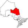 | |
|---|---|---|
| Towns | ||
| Townships | ||
| First Nations | ||
| Indian reserves | ||
| Indian settlements | ||
| Unorganized territories | ||
| Local services boards | ||
| Unincorporated communities |
| |
| ||
This article is issued from
Wikipedia.
The text is licensed under Creative Commons - Attribution - Sharealike.
Additional terms may apply for the media files.