Charmois, Territoire de Belfort
| Charmois | ||
|---|---|---|
| Commune | ||
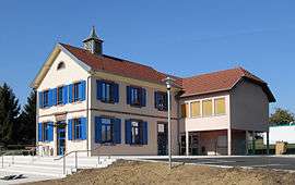 Town hall-school | ||
| ||
 Charmois Location within Bourgogne-Franche-Comté region  Charmois | ||
| Coordinates: 47°34′29″N 6°56′19″E / 47.5747°N 6.9386°ECoordinates: 47°34′29″N 6°56′19″E / 47.5747°N 6.9386°E | ||
| Country | France | |
| Region | Bourgogne-Franche-Comté | |
| Department | Territoire de Belfort | |
| Arrondissement | Belfort | |
| Canton | Châtenois-les-Forges | |
| Intercommunality | Belfortaine | |
| Government | ||
| • Mayor (2014–2020) | Jean-Claude Hauteroche | |
| Area1 | 4.17 km2 (1.61 sq mi) | |
| Population (2006)2 | 298 | |
| • Density | 71/km2 (190/sq mi) | |
| Time zone | UTC+1 (CET) | |
| • Summer (DST) | UTC+2 (CEST) | |
| INSEE/Postal code | 90021 /90140 | |
| Elevation | 330–371 m (1,083–1,217 ft) | |
|
1 French Land Register data, which excludes lakes, ponds, glaciers > 1 km2 (0.386 sq mi or 247 acres) and river estuaries. 2 Population without double counting: residents of multiple communes (e.g., students and military personnel) only counted once. | ||
.svg.png)
Charmois is a commune in the Territoire de Belfort department in Bourgogne-Franche-Comté in northeastern France.
The inhabitants of the town of Charmois are "Charmoyens, Charmoyennes".[1]
Population
| Year | 1962 | 1968 | 1975 | 1982 | 1990 | 1999 | 2006 | 2007 |
|---|---|---|---|---|---|---|---|---|
| Population | 116 | 121 | 115 | 203 | 227 | 261 | 286 | 289[3] |
| From the year 1962 on: No double counting—residents of multiple communes (e.g. students and military personnel) are counted only once. | ||||||||
See also
| Wikimedia Commons has media related to Charmois. |
References
This article is issued from
Wikipedia.
The text is licensed under Creative Commons - Attribution - Sharealike.
Additional terms may apply for the media files.