Giromagny
| Giromagny | ||
|---|---|---|
| Commune | ||
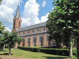 Saint-Jean-Baptiste church | ||
| ||
 Giromagny Location within Bourgogne-Franche-Comté region  Giromagny | ||
| Coordinates: 47°44′33″N 6°49′35″E / 47.7425°N 6.8264°ECoordinates: 47°44′33″N 6°49′35″E / 47.7425°N 6.8264°E | ||
| Country | France | |
| Region | Bourgogne-Franche-Comté | |
| Department | Territoire de Belfort | |
| Arrondissement | Belfort | |
| Canton | Giromagny | |
| Intercommunality | Haute Savoureuse | |
| Government | ||
| • Mayor (2014–2020) | Jacques Colin | |
| Area1 | 5.65 km2 (2.18 sq mi) | |
| Population (2015)2 | 3,130 | |
| • Density | 550/km2 (1,400/sq mi) | |
| Time zone | UTC+1 (CET) | |
| • Summer (DST) | UTC+2 (CEST) | |
| INSEE/Postal code | 90052 /90200 | |
| Elevation | 452–800 m (1,483–2,625 ft) | |
|
1 French Land Register data, which excludes lakes, ponds, glaciers > 1 km2 (0.386 sq mi or 247 acres) and river estuaries. 2 Population without double counting: residents of multiple communes (e.g., students and military personnel) only counted once. | ||
.svg.png)
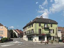
Giromagny is a commune in the Territoire de Belfort department in Bourgogne-Franche-Comté in northeastern France.
Memorial of the union of Alsace to France in 1648
See also
| Wikimedia Commons has media related to Giromagny. |
References
External links
- Official website (in French)
This article is issued from
Wikipedia.
The text is licensed under Creative Commons - Attribution - Sharealike.
Additional terms may apply for the media files.