Lamadeleine-Val-des-Anges
| Lamadeleine-Val-des-Anges | |
|---|---|
| Commune | |
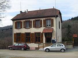 Town hall | |
 Lamadeleine-Val-des-Anges Location within Bourgogne-Franche-Comté region  Lamadeleine-Val-des-Anges | |
| Coordinates: 47°45′43″N 6°54′50″E / 47.7619°N 6.9139°ECoordinates: 47°45′43″N 6°54′50″E / 47.7619°N 6.9139°E | |
| Country | France |
| Region | Bourgogne-Franche-Comté |
| Department | Territoire de Belfort |
| Arrondissement | Belfort |
| Canton | Giromagny |
| Intercommunality | Pays sous Vosgien |
| Government | |
| • Mayor (2014–2020) | René Zappini |
| Area1 | 6.52 km2 (2.52 sq mi) |
| Population (2006)2 | 33 |
| • Density | 5.1/km2 (13/sq mi) |
| Time zone | UTC+1 (CET) |
| • Summer (DST) | UTC+2 (CEST) |
| INSEE/Postal code | 90061 /90170 |
| Elevation | 537–1,075 m (1,762–3,527 ft) |
|
1 French Land Register data, which excludes lakes, ponds, glaciers > 1 km2 (0.386 sq mi or 247 acres) and river estuaries. 2 Population without double counting: residents of multiple communes (e.g., students and military personnel) only counted once. | |
Lamadeleine-Val-des-Anges is a commune in the Territoire de Belfort department in Bourgogne-Franche-Comté in northeastern France.
See also
| Wikimedia Commons has media related to Lamadeleine-Val-des-Anges. |
References
This article is issued from
Wikipedia.
The text is licensed under Creative Commons - Attribution - Sharealike.
Additional terms may apply for the media files.