Charlotte, New York
| Charlotte, New York | |
|---|---|
| Town | |
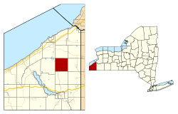 Location within Chautauqua County and New York | |
 Charlotte Location within the state of New York | |
| Coordinates: 42°17′41″N 79°14′27″W / 42.29472°N 79.24083°W | |
| Country | United States |
| State | New York |
| County | Chautauqua |
| Government | |
| • Type | Town Council |
| • Town Supervisor | Kenneth W. Bochmann (D) |
| • Town Council |
Members' List
|
| Area[1] | |
| • Total | 36.42 sq mi (94.34 km2) |
| • Land | 36.42 sq mi (94.34 km2) |
| • Water | 0.00 sq mi (0.00 km2) |
| Elevation | 1,542 ft (470 m) |
| Population (2010) | |
| • Total | 1,729 |
| • Estimate (2016)[2] | 1,667 |
| • Density | 45.77/sq mi (17.67/km2) |
| Time zone | UTC-5 (Eastern (EST)) |
| • Summer (DST) | UTC-4 (EDT) |
| FIPS code | 36-013-13860 |
| GNIS feature ID | 0978811 |
| Website |
charlotteny |
Charlotte is a town in Chautauqua County, New York, United States. As of the 2010 census, the town population was 1,729.[3] Charlotte is centrally located in the county, north of Jamestown and south of Dunkirk.
History
The area was first settled around 1809. The town of Charlotte was founded in 1829 from a division of the town of Gerry. In 1900, the population was 1,406.
Geography
According to the United States Census Bureau, the town has a total area of 36.4 square miles (94.4 km2), all of it land.[3]
New York State Route 60 is a major north-south route near the west town line.
Mill Creek flows southwest through the town.
Notable people
- Columbus Caldwell, Wisconsin politician
- Jonathan Child, first mayor of Rochester, New York
- Henry H. Straight, educator and college president
- Charles L. Webster, Mark Twain's business manager
Adjacent towns and areas
Demographics
| Historical population | |||
|---|---|---|---|
| Census | Pop. | %± | |
| 1830 | 886 | — | |
| 1840 | 1,428 | 61.2% | |
| 1850 | 1,718 | 20.3% | |
| 1860 | 1,711 | −0.4% | |
| 1870 | 1,682 | −1.7% | |
| 1880 | 1,667 | −0.9% | |
| 1890 | 1,441 | −13.6% | |
| 1900 | 1,400 | −2.8% | |
| 1910 | 1,258 | −10.1% | |
| 1920 | 1,173 | −6.8% | |
| 1930 | 1,208 | 3.0% | |
| 1940 | 1,146 | −5.1% | |
| 1950 | 1,195 | 4.3% | |
| 1960 | 1,323 | 10.7% | |
| 1970 | 1,400 | 5.8% | |
| 1980 | 1,494 | 6.7% | |
| 1990 | 1,528 | 2.3% | |
| 2000 | 1,713 | 12.1% | |
| 2010 | 1,729 | 0.9% | |
| Est. 2016 | 1,667 | [2] | −3.6% |
| U.S. Decennial Census[4] | |||
As of the census[5] of 2000, there were 1,713 people, 612 households, and 457 families residing in the town. The population density is 46.9 people per square mile (18.1/km²). There are 704 housing units at an average density of 19.3 per square mile (7.4/km²). The racial makeup of the town was 98.42% White, 0.18% Native American, 0.29% Asian, 0.35% from other races, and 0.76% from two or more races. 1.40% of the population was Hispanic or Latino of any race.
There was 612 households out of which 36.4% have children under the age of 18 living with them, 60.0% are married couples living together, 9.8% have a female householder with no husband present, and 25.2% are non-families. 20.3% of all households are made up of individuals and 10.9% have someone living alone who is 65 years of age or older. The average household size is 2.80 and the average family size is 3.22.
In the town the population was spread out with 29.6% under the age of 18, 7.5% from 18 to 24, 28.3% from 25 to 44, 22.7% from 45 to 64, and 12.0% who was 65 years of age or older. The median age is 35 years. For every 100 females, there are 99.9 males. For every 100 females age 18 and over, there was 99.7 males.
The median income for a household in the town is $35,192, and the median income for a family is $40,893. Males have a median income of $32,009 versus $22,734 for females. The per capita income for the town is $15,733. 11.7% of the population and 10.1% of families are below the poverty line. Out of the total population, 13.1% of those under the age of 18 and 17.8% of those 65 and older are living below the poverty line.
As of the census of 2010, there were 1,729 people (an increase of 0.93% or 16 people) and 670 households residing in the town. The population density was 47.4 people per square mile (18.3/km²). The racial makeup of the town was 97.92% (1,693 people) white, 0.17% (3 people) African-American, 0.29% (5 people) Asian, 0.29% (5 people) Native American/Alaskan, 0.46% (8 people) other, and 0.87% (15 people) two or more races. 2.02% of the population was Hispanic/Latino of any race.
Out of the 670 households, 32.4% of them had children under the age of 18 living with them.
In the town, the population was spread out with 24.0% (415 people) under the age of 18, 2.72% (47 people) ages 18 and 19, 5.55% (96 people) ages 20–24, 10.41% (180 people) ages 25–34, 22.73% (393 people) ages 35–49, 21.63% (374 people) ages 50–64, and 12.96% (224 people) over the age of 65. 51.3% (887 people) of the population was male while 48.7% (842 people) were female.[6]
Communities and locations in Charlotte
- Arab Hill – A location near the eastern town line. It is one of the highest points in Chautauqua County at 2,100 feet (640 m).[7]
- Charlotte Center – A hamlet northeast of Sinclairville on County Road 77.
- Charlotte Center Gap Filler Annex[8] – A former military establishment and commercial transmitter site at the top of Arab Hill.
- Moons – A hamlet near the western town line, located on Route 60.
- Pettit Corners – A location northwest of Sinclairville and west of Charlotte Center on Hooker Road.
- Pickett Corners (Pickett School) – A hamlet in the northwest corner of the town on County Road 75. This community was the site of the first settlement in the town.
- Sinclairville – A part of the village of Sinclairville is in the southwest corner of the town at the junction of County Roads 64, 66, and 77.
References
- ↑ "2016 U.S. Gazetteer Files". United States Census Bureau. Retrieved Jul 4, 2017.
- 1 2 "Population and Housing Unit Estimates". Retrieved June 9, 2017.
- 1 2 "Geographic Identifiers: 2010 Demographic Profile Data (G001): Charlotte town, Chautauqua County, New York". U.S. Census Bureau, American Factfinder. Retrieved November 5, 2014.
- ↑ "Census of Population and Housing". Census.gov. Archived from the original on May 12, 2015. Retrieved June 4, 2015.
- ↑ "American FactFinder". United States Census Bureau. Archived from the original on 2013-09-11. Retrieved 2008-01-31.
- ↑ "2010 US Census". Retrieved 13 September 2012.
- ↑ "Geographic Names Information System (GNIS)".
- ↑ http://www.radomes.org/museum/
External links
Municipalities and communities of Chautauqua County, New York, United States | ||
|---|---|---|
| Cities | 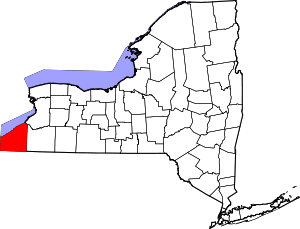 | |
| Towns | ||
| Villages | ||
| CDPs | ||
| Other hamlets | ||
| Indian reservation | ||