Sinclairville, New York
| Sinclairville, New York | |
|---|---|
| Village | |
 Sinclairville Location within the state of New York | |
| Coordinates: 42°15′44″N 79°15′43″W / 42.26222°N 79.26194°WCoordinates: 42°15′44″N 79°15′43″W / 42.26222°N 79.26194°W | |
| Country | United States |
| State | New York |
| County | Chautauqua |
| Towns |
Charlotte, Gerry |
| Area | |
| • Total | 1.6 sq mi (4.2 km2) |
| • Land | 1.6 sq mi (4.2 km2) |
| • Water | 0.0 sq mi (0.0 km2) |
| Elevation | 1,401 ft (427 m) |
| Population (2010) | |
| • Total | 588 |
| • Estimate (2016)[1] | 558 |
| • Density | 360/sq mi (140/km2) |
| Time zone | UTC-5 (Eastern (EST)) |
| • Summer (DST) | UTC-4 (EDT) |
| ZIP code | 14782 |
| Area code(s) | 716 |
| FIPS code | 36-67488 |
| GNIS feature ID | 0965303 |
Sinclairville is a village in Chautauqua County, New York, United States. The population was 588 at the 2010 census.[2] The village is named after Major Samuel Sinclear, its founder. Sinclairville is north of Jamestown and is on the border of the towns of Charlotte and Gerry.
History
The village was founded in 1809 after the American Revolutionary War by Major Samuel Sinclear as "Sinclearville". The area was previously inhabited for hundreds of years by the Seneca people of the Iroquois Confederacy (Haudenosaunee) who, as allies of the British during the war, were forced to cede most of their lands to the United States and New York state. Most of the Iroquois migrated to Upper Canada, where they were given lands by the Crown.
The village of Sinclairville was incorporated in 1887. Sinclairville calls itself "The Heart of Chautauqua County".
Notable people
- Martha Angle Dorsett (1851–1918), first woman attorney in Minnesota, wife of Charles Dorsett
- George Burritt Sennett (1840-1900), ichthyologist and ornithologist
- Rexford Tugwell (1891–1979), economist and New Deal theoretician
Geography
Sinclairville is located in east-central Chautauqua County at 42°15′44″N 79°15′43″W / 42.26222°N 79.26194°W (42.262227, -79.261975).[3] The center of the village and about two-thirds of its area are in the town of Charlotte, while the southern one-third is in the town of Gerry.
According to the United States Census Bureau, the village has a total area of 1.6 square miles (4.2 km2), all of it land.[2]
Mill Creek, a tributary of Cassadaga Creek, runs through the town. Via Cassadaga Creek and then Conewango Creek, the village is part of the Allegheny River watershed.
The village is at the intersection of County Roads 64, 66, and 77. Jamestown on Chautauqua Lake is 12 miles (19 km) to the south, and Dunkirk on Lake Erie is 18 miles (29 km) to the north.
Demographics
| Historical population | |||
|---|---|---|---|
| Census | Pop. | %± | |
| 1880 | 540 | — | |
| 1890 | 510 | −5.6% | |
| 1900 | 577 | 13.1% | |
| 1910 | 542 | −6.1% | |
| 1920 | 514 | −5.2% | |
| 1930 | 589 | 14.6% | |
| 1940 | 585 | −0.7% | |
| 1950 | 672 | 14.9% | |
| 1960 | 726 | 8.0% | |
| 1970 | 772 | 6.3% | |
| 1980 | 772 | 0.0% | |
| 1990 | 708 | −8.3% | |
| 2000 | 665 | −6.1% | |
| 2010 | 588 | −11.6% | |
| Est. 2016 | 558 | [1] | −5.1% |
| U.S. Decennial Census[4] | |||
As of the census[5] of 2000, there were 665 people, 268 households, and 173 families residing in the village. The population density was 412.1 people per square mile (159.5/km²). There were 292 housing units at an average density of 180.9 per square mile (70.0/km²). The racial makeup of the village was 97.74% White, 0.15% African American, 0.45% Native American, 0.45% Asian, 0.15% from other races, and 1.05% from two or more races. Hispanic or Latino of any race were 0.90% of the population.
There were 268 households out of which 29.9% had children under the age of 18 living with them, 51.9% were married couples living together, 9.0% had a female householder with no husband present, and 35.1% were non-families. 29.5% of all households were made up of individuals and 18.7% had someone living alone who was 65 years of age or older. The average household size was 2.48 and the average family size was 3.05.
In the village, the population was spread out with 26.2% under the age of 18, 9.0% from 18 to 24, 26.2% from 25 to 44, 22.0% from 45 to 64, and 16.7% who were 65 years of age or older. The median age was 36 years. For every 100 females, there were 94.4 males. For every 100 females age 18 and over, there were 88.8 males.
The median income for a household in the village was $26,625, and the median income for a family was $32,955. Males had a median income of $34,167 versus $23,958 for females. The per capita income for the village was $14,415. About 21.2% of families and 22.6% of the population were below the poverty line, including 31.7% of those under age 18 and 21.5% of those age 65 or over.
As of the census of 2010, there were 588 people (a decrease of 77 people or 11.58%) and 255 households (a decrease of 13 households or 4.85%) within the village. The population density was 367.5 people per square mile (140.0/km²). The racial makeup of the village was: 97.28% (572 people) white; 0.51% (3 people) Asian; 0.34% (2 people) Native American/Alaskan; 0.17% (1 person) other; and 1.70% (10 people) of two or more races. The Hispanic/Latino population of any race was 2.04% (12 people).
In the village, the population was spread out with 22.62% of the population under the age of 18, 3.23% of the population ages 18 and 19, 6.80% ages 20–24, 10.03% ages 25–34, 21.77% ages 35–49, 20.41% ages 50–64, and 15.14% of the population over the age of 65. Out of the population, 50.51% (297 people) were male and 49.49% (291 people) were female.[6]
References
- 1 2 "Population and Housing Unit Estimates". Retrieved June 9, 2017.
- 1 2 "Geographic Identifiers: 2010 Demographic Profile Data (G001): Sinclairville village, New York". U.S. Census Bureau, American Factfinder. Retrieved November 12, 2014.
- ↑ "US Gazetteer files: 2010, 2000, and 1990". United States Census Bureau. 2011-02-12. Retrieved 2011-04-23.
- ↑ "Census of Population and Housing". Census.gov. Retrieved June 4, 2015.
- ↑ "American FactFinder". United States Census Bureau. Retrieved 2008-01-31.
- ↑ "2010 US Census". Archived from the original on 8 January 2012. Retrieved 14 September 2012.
External links
Municipalities and communities of Chautauqua County, New York, United States | ||
|---|---|---|
| Cities | 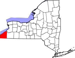 | |
| Towns | ||
| Villages | ||
| CDPs | ||
| Other hamlets | ||
| Indian reservation | ||