Kryonerida
| Kryonerida Κρυονερίδα | |
|---|---|
 Kryonerida Location within the regional unit 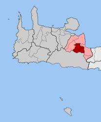 | |
| Coordinates: 35°20′N 24°12′E / 35.333°N 24.200°ECoordinates: 35°20′N 24°12′E / 35.333°N 24.200°E | |
| Country | Greece |
| Administrative region | Crete |
| Regional unit | Chania |
| Municipality | Apokoronas |
| • Municipal unit | 67.6 km2 (26.1 sq mi) |
| Elevation | 184 m (604 ft) |
| Population (2011)[1] | |
| • Municipal unit | 1,993 |
| • Municipal unit density | 29/km2 (76/sq mi) |
| Time zone | UTC+2 (EET) |
| • Summer (DST) | UTC+3 (EEST) |
| Postal code | 730 07 |
| Area code(s) | 28250 |
| Vehicle registration | ΧΝ |
Kryonerida (Greek: Κρυονερίδα) is a former municipality in the Chania regional unit, Crete, Greece. Since the 2011 local government reform it is part of the municipality Apokoronas, of which it is a municipal unit.[2] The municipal unit has an area of 67.561 km2 (26.085 sq mi).[3] The seat of the municipality of Kryonerida was the large village of Vryses. Vryses became the seat of the new municipality Apokoronas. It is located in foothills of the White Mountains (Lefka Ori).
Subdivisions
The municipal unit Kryonerida is subdivided into the following communities (constituent villages in brackets):
See also
References
- ↑ "Απογραφή Πληθυσμού - Κατοικιών 2011. ΜΟΝΙΜΟΣ Πληθυσμός" (in Greek). Hellenic Statistical Authority.
- ↑ Kallikratis law Greece Ministry of Interior (in Greek)
- ↑ "Population & housing census 2001 (incl. area and average elevation)" (PDF) (in Greek). National Statistical Service of Greece. Archived from the original (PDF) on 2015-09-21.
External links
This article is issued from
Wikipedia.
The text is licensed under Creative Commons - Attribution - Sharealike.
Additional terms may apply for the media files.