Celina, Minnesota
| Celina, Minnesota | |
|---|---|
| Unincorporated community | |
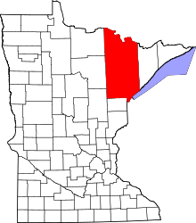
 Celina, Minnesota Location of the community of Celina within Saint Louis County  Celina, Minnesota Celina, Minnesota (the US) | |
| Coordinates: 47°51′57″N 93°03′43″W / 47.86583°N 93.06194°WCoordinates: 47°51′57″N 93°03′43″W / 47.86583°N 93.06194°W | |
| Country | United States |
| State | Minnesota |
| County | Saint Louis |
| Elevation | 1,319 ft (402 m) |
| Population | |
| • Total | 10 |
| Time zone | UTC-6 (Central (CST)) |
| • Summer (DST) | UTC-5 (CDT) |
| ZIP code | 55723 |
| Area code(s) | 218 |
| GNIS feature ID | 660973[1] |
Celina is an unincorporated community in Saint Louis County, Minnesota, United States.
The community is located 18 miles west of Cook at the junction of State Highway 1 (MN 1) and Saint Louis County Highway 5 (CR 5).
The boundary line between Saint Louis, Itasca, and Koochiching counties is near Celina.
The communities of Greaney, Bear River, and Togo are nearby.
References
- Official State of Minnesota Highway Map – 2011/2012 edition
This article is issued from
Wikipedia.
The text is licensed under Creative Commons - Attribution - Sharealike.
Additional terms may apply for the media files.