Wahlsten, Minnesota
| Wahlsten, Minnesota | |
|---|---|
| Unincorporated community | |
 Wahlsten, Minnesota Location of the community of Wahlsten within Kugler Township, Saint Louis County  Wahlsten, Minnesota Wahlsten, Minnesota (the US) | |
| Coordinates: 47°44′09″N 92°17′01″W / 47.73583°N 92.28361°WCoordinates: 47°44′09″N 92°17′01″W / 47.73583°N 92.28361°W | |
| Country | United States |
| State | Minnesota |
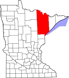
| County | Saint Louis |
| Township | Kugler Township |
| Elevation | 1,470 ft (450 m) |
| Population | |
| • Total | 10 |
| Time zone | UTC-6 (Central (CST)) |
| • Summer (DST) | UTC-5 (CDT) |
| ZIP codes | 55790 or 55732 |
| Area code(s) | 218 |
| GNIS feature ID | 662729[1] |
Wahlsten is an unincorporated community in Kugler Township, Saint Louis County, Minnesota, United States.
Geography
The community is located 5 miles south of Tower at the intersection of State Highway 135 (MN 135) and Saint Louis County Road 26 (Wahlsten Road). Wahlsten is located 17 miles north of Aurora. State Highway 169 (MN 169) and the Pike River are nearby. The community of Embarrass is also in the area.
History
The community was named for August Wahlsten, a Swedish settler.[2]
References
- ↑ "Wahlsten, Minnesota". Geographic Names Information System. United States Geological Survey.
- ↑ Upham, Warren (1920). Minnesota Geographic Names: Their Origin and Historic Significance. Minnesota Historical Society. p. 491.
- Official State of Minnesota Highway Map – 2011/2012 edition
This article is issued from
Wikipedia.
The text is licensed under Creative Commons - Attribution - Sharealike.
Additional terms may apply for the media files.