Catmon, Cebu
| Catmon | ||
|---|---|---|
| Municipality | ||
| Municipality of Catmon | ||
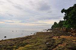 Beach in Panalipan, Catmon | ||
| ||
 Map of Cebu with Catmon highlighted | ||
.svg.png) Catmon Location within the Philippines | ||
| Coordinates: 10°40′N 123°57′E / 10.67°N 123.95°ECoordinates: 10°40′N 123°57′E / 10.67°N 123.95°E | ||
| Country |
| |
| Region | Central Visayas (Region VII) | |
| Province | Cebu | |
| District | 5th district of Cebu | |
| Founded | 1903 | |
| Barangays | 20 (see Barangays) | |
| Government [1] | ||
| • Type | Sangguniang Bayan | |
| • Mayor | Dan Jusay | |
| • Vice Mayor | Irish Baylon-Gestopa | |
| • Congressman | Red Durano | |
| • Electorate | 17,150 voters (2016) | |
| Area [2] | ||
| • Total | 109.64 km2 (42.33 sq mi) | |
| Elevation | 360 m (1,180 ft) | |
| Population (2015 census)[3] | ||
| • Total | 30,471 | |
| • Density | 280/km2 (720/sq mi) | |
| Time zone | UTC+8 (PST) | |
| ZIP code | 6006 | |
| PSGC | 072216000 | |
| IDD : area code | +63 (0)32 | |
| Climate type | Tropical climate | |
| Income class | 4th municipal income class | |
| Revenue (₱) | 86,076,371.02 (2016) | |
| Native languages |
Cebuano Tagalog | |

Catmon, officially the Municipality of Catmon, (Cebuano: Lungsod sa Catmon; Tagalog: Bayan ng Catmon), is a 4th class municipality in the province of Cebu, Philippines. According to the 2015 census, it has a population of 30,471 people.[3]
Catmon is bordered on the north by the town of Sogod, to the west by the town of Tuburan, on the east by the Camotes Sea, and on the south by the town of Carmen.
Catmon's topography is generally mountainous and hilly but patches of flat lands can be found along the coastline and portion of the poblacion.
The municipality's climate is of Coronas climate type IV, where rainfall is evenly distributed throughout the year.
Mount Capayas (Kapayas) (also known as Tore Peak), Cebu's second highest peak, is located in Cambangkaya. Mount Capayas is one of the Key Biodiversity Areas (KBAs) of Cebu.[4]
The municipality got its name from the presence of huge trees called katmon (dillenia philippinensis) that thrive in this area.
The town fiesta is celebrated every 10th of February in honor of their patron saint, San Guillermo de Aquitania. Part of the annual fiesta is the Budbod Kabog Festival and participated by the public schools.
Barangays
Catmon comprises 20 barangays:
| PSGC | Barangay | Population | ±% p.a. | |||
|---|---|---|---|---|---|---|
| 2015[3] | 2010[5] | |||||
| 072216001 | Agsuwao | 3.3% | 1,008 | 1,004 | 0.08% | |
| 072216002 | Amancion | 0.7% | 207 | 210 | −0.27% | |
| 072216003 | Anapog | 1.1% | 324 | 327 | −0.18% | |
| 072216004 | Bactas | 2.8% | 867 | 878 | −0.24% | |
| 072216006 | Basak | 4.2% | 1,286 | 1,163 | 1.93% | |
| 072216007 | Binongkalan | 5.2% | 1,587 | 1,417 | 2.18% | |
| 072216005 | Bongyas | 1.0% | 300 | 317 | −1.04% | |
| 072216008 | Cabungaan | 4.6% | 1,413 | 1,265 | 2.13% | |
| 072216009 | Cambangkaya | 2.5% | 758 | 768 | −0.25% | |
| 072216010 | Can‑ibuang | 1.3% | 398 | 419 | −0.97% | |
| 072216011 | Catmondaan | 10.1% | 3,086 | 2,792 | 1.92% | |
| 072216019 | Corazon (Poblacion) | 9.8% | 2,994 | 2,836 | 1.04% | |
| 072216012 | Duyan | 2.2% | 684 | 549 | 4.28% | |
| 072216020 | Flores (Poblacion) | 9.9% | 3,023 | 2,865 | 1.03% | |
| 072216013 | Ginabucan | 2.7% | 809 | 874 | −1.46% | |
| 072216014 | Macaas | 11.1% | 3,394 | 3,093 | 1.78% | |
| 072216015 | Panalipan | 11.6% | 3,544 | 3,161 | 2.20% | |
| 072216018 | San Jose Pob. (Catadman) | 10.7% | 3,250 | 2,832 | 2.66% | |
| 072216016 | Tabili | 2.5% | 764 | 719 | 1.16% | |
| 072216017 | Tinabyonan | 2.5% | 775 | 831 | −1.32% | |
| Total | 30,471 | 28,320 | 1.40% | |||
Demographics
| Population census of Catmon | ||
|---|---|---|
| Year | Pop. | ±% p.a. |
| 1903 | 7,027 | — |
| 1918 | 18,646 | +6.72% |
| 1939 | 11,738 | −2.18% |
| 1948 | 11,761 | +0.02% |
| 1960 | 13,412 | +1.10% |
| 1970 | 14,837 | +1.01% |
| 1975 | 15,923 | +1.43% |
| 1980 | 17,357 | +1.74% |
| 1990 | 19,773 | +1.31% |
| 1995 | 21,647 | +1.71% |
| 2000 | 25,083 | +3.21% |
| 2007 | 27,330 | +1.19% |
| 2010 | 28,320 | +1.30% |
| 2015 | 30,471 | +1.40% |
| Source: Philippine Statistics Authority[3] [5] [6] [7] | ||
References
- ↑ "Municipality". Quezon City, Philippines: Department of the Interior and Local Government. Retrieved 31 May 2013.
- ↑ "Province: Cebu". PSGC Interactive. Quezon City, Philippines: Philippine Statistics Authority. Retrieved 12 November 2016.
- 1 2 3 4 Census of Population (2015). "Region VII (Central Visayas)". Total Population by Province, City, Municipality and Barangay. PSA. Retrieved 20 June 2016.
- ↑ Philippine Sun Star 2014.
- 1 2 Census of Population and Housing (2010). "Region VII (Central Visayas)". Total Population by Province, City, Municipality and Barangay. NSO. Retrieved 29 June 2016.
- ↑ Censuses of Population (1903–2007). "Region VII (Central Visayas)". Table 1. Population Enumerated in Various Censuses by Province/Highly Urbanized City: 1903 to 2007. NSO.
- ↑ "Province of Cebu". Municipality Population Data. Local Water Utilities Administration Research Division. Retrieved 17 December 2016.
Sources
Philippine Sun Star, Razel V. Cuizon (20 September 2014). "LGUs agree to protect biodiversity hotspots". Cebu. Archived from the original on 30 November 2014.
External links
Places adjacent to Catmon, Cebu | ||||||||||
|---|---|---|---|---|---|---|---|---|---|---|
| ||||||||||
Cebu City (capital) | |
| Municipalities |
|
| Component cities | |
| Highly urbanized cities | (Administratively independent from the province but grouped under Cebu by the Philippine Statistics Authority. However, qualified voters in Mandaue are allowed to vote in elections for Cebu provincial officials as part of the 6th Sangguniang Panlalawigan district.) |