Canebrake (Ferriday, Louisiana)
|
Canebrake | |
 | |
| Location | Along Maxwell Road, about 2.9 miles (4.7 km) east of Spokane, Louisiana and about 9.7 miles (15.6 km) northeast of Ferriday |
|---|---|
| Nearest city | Ferriday, Louisiana |
| Coordinates | 31°41′56″N 91°24′41″W / 31.69881°N 91.4113°WCoordinates: 31°41′56″N 91°24′41″W / 31.69881°N 91.4113°W |
| Area | 8.5 acres (3.4 ha) |
| Built | 1840 |
| NRHP reference # | 82002767[1] |
| Added to NRHP | August 29, 1982 |
Canebrake is a historic plantation house in Ferriday, Louisiana. The house was located inside a 531 acres (215 ha) plantation west of Mississippi River and east of Lake St. John.[2][3]
The house was built in c.1840 and has been remodeled in 1850-1860 and in 1910, after the plantation was purchased by Arthur Meserve. [4][2][3]
The house and the nearby 8.5 acres (3.4 ha) area, comprising several outbuildings was listed on the National Register of Historic Places on August 29, 1982.[1]
See also
References
- 1 2 National Park Service (2010-07-09). "National Register Information System". National Register of Historic Places. National Park Service.
- 1 2 "Canebrake" (PDF). State of Louisiana's Division of Historic Preservation. 1982. Retrieved April 27, 2018. with three photos and two maps
- 1 2 Mary Warren Miller (October 15, 1980). "National Register of Historic Places Inventory/Nomination Form: Canebrake". National Park Service. Retrieved April 27, 2018. With six photos from 1980.
- ↑ "Canebrake". National Park Service. Retrieved July 18, 2016.


Municipalities and communities of Concordia Parish, Louisiana, United States | ||
|---|---|---|
| Cities | 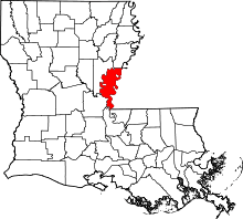 | |
| Towns | ||
| CDPs | ||
| Other unincorporated communities |
| |
This article is issued from
Wikipedia.
The text is licensed under Creative Commons - Attribution - Sharealike.
Additional terms may apply for the media files.