Candijay, Bohol
| Candijay | |
|---|---|
| Municipality | |
| Municipality of Candijay | |
 Candijay Town Hall | |
 Map of Bohol with Candijay highlighted | |
.svg.png) Candijay Location within the Philippines | |
| Coordinates: 9°49′N 124°30′E / 9.82°N 124.5°ECoordinates: 9°49′N 124°30′E / 9.82°N 124.5°E | |
| Country |
|
| Region | Central Visayas (Region VII) |
| Province | Bohol |
| District | 3rd District |
| Founded | 29 November 1854 |
| Barangays | 21 (see Barangays) |
| Government [1] | |
| • Type | Sangguniang Bayan |
| • Mayor | Christopher B. Tutor |
| • Vice Mayor | Susan Mapute |
| • Congressman | Arthur Yap |
| • Electorate | 19,708 voters (2016) |
| Area [2] | |
| • Total | 103.26 km2 (39.87 sq mi) |
| Population (2015 census)[3] | |
| • Total | 29,475 |
| • Density | 290/km2 (740/sq mi) |
| Time zone | UTC+8 (PST) |
| ZIP code | 6312 |
| PSGC | 071211000 |
| IDD : area code | +63 (0)38 |
| Climate type | Tropical monsoon climate |
| Income class | 4th municipal income class |
| Revenue (₱) | 91,170,941.92 (2016) |
| Native languages |
Boholano dialect Cebuano Tagalog |
| Website |
candijay-bohol |
Candijay, officially the Municipality of Candijay, (Cebuano: Lungsod sa Candijay; Tagalog: Bayan ng Candijay), is a 4th class municipality in the province of Bohol, Philippines. According to the 2015 census, it has a population of 29,475 people.[3]
Candijay is home to the Bohol Island State University (BISU) School of Fisheries, offering college courses related to modern fishing methods and fish preservation. It also has educational facilities for elementary and secondary levels in almost all barangays of the municipality.
History
The name of the town is said to have come from the words "Kang Dihay" meaning belonging to Dihay, a strong man with many followers. The name was eventually changed to Candijay and was organized during the Spanish regime and was then one of the 34 towns in the province in 1879 with a population of 5,030.
The municipality of Candijay was established in 1879 and so was its establishment as a parish. The people were eventually converted to the Roman Catholic religion by the Spaniards. The parochial church of Candijay is dedicated to Saint Joseph whose feast day is 19 May.
Geography
The municipality of Candijay is located on the eastern side of Bohol, 92 kilometres (57 mi) from Tagbilaran, a two-hour ride away. The town has a land area of 8,687 hectares (21,470 acres).
The town faces Cogtong Bay which has the most diverse mangrove ecosystem in Bohol. The bay is home to 32 of the Philippines' 47 species of mangroves and associates. Yet due to illegal fishing and mismanagement of the mangroves, the mangroves and marine life in the area dwindled. To rectify the damage done, the municipal government is now engaged in a coastal resource management program: the planting of mangroves, though the control and eventual abolition of illegal fishing has yet to be addressed.
Barangays
Candijay comprises 21 barangays.
| PSGC | Barangay | Population | ±% p.a. | |||
|---|---|---|---|---|---|---|
| 2015[3] | 2010[4] | |||||
| 071211001 | Abihilan | 5.4% | 1,603 | 1,209 | 5.52% | |
| 071211002 | Anoling | 3.8% | 1,113 | 1,114 | −0.02% | |
| 071211003 | Boyo‑an | 5.5% | 1,610 | 1,612 | −0.02% | |
| 071211004 | Cadapdapan | 4.3% | 1,273 | 1,381 | −1.54% | |
| 071211005 | Cambane | 1.4% | 416 | 435 | −0.85% | |
| 071211006 | Can‑olin | 7.3% | 2,155 | 2,215 | −0.52% | |
| 071211007 | Canawa | 4.6% | 1,370 | 1,415 | −0.61% | |
| 071211008 | Cogtong | 8.8% | 2,605 | 2,492 | 0.85% | |
| 071211009 | La Union | 4.9% | 1,449 | 1,365 | 1.14% | |
| 071211010 | Luan | 2.5% | 731 | 886 | −3.60% | |
| 071211011 | Lungsoda‑an | 5.1% | 1,499 | 1,461 | 0.49% | |
| 071211012 | Mahangin | 3.0% | 891 | 906 | −0.32% | |
| 071211013 | Pagahat | 2.3% | 669 | 1,000 | −7.37% | |
| 071211014 | Panadtaran | 3.3% | 969 | 1,002 | −0.64% | |
| 071211015 | Panas | 5.7% | 1,675 | 1,477 | 2.42% | |
| 071211016 | Poblacion | 11.6% | 3,421 | 3,344 | 0.43% | |
| 071211017 | San Isidro | 3.8% | 1,124 | 1,042 | 1.45% | |
| 071211018 | Tambongan | 5.2% | 1,542 | 1,587 | −0.55% | |
| 071211019 | Tawid | 3.7% | 1,090 | 1,089 | 0.02% | |
| 071211022 | Tubod (Tres Rosas) | 3.0% | 888 | 928 | −0.84% | |
| 071211021 | Tugas | 5.6% | 1,650 | 1,640 | 0.12% | |
| Total | 29,475 | 29,043 | 0.28% | |||
Demographics
| Population census of Candijay | ||
|---|---|---|
| Year | Pop. | ±% p.a. |
| 1903 | 6,522 | — |
| 1918 | 8,372 | +1.68% |
| 1939 | 13,749 | +2.39% |
| 1948 | 15,658 | +1.46% |
| 1960 | 16,035 | +0.20% |
| 1970 | 17,114 | +0.65% |
| 1975 | 19,750 | +2.91% |
| 1980 | 21,342 | +1.56% |
| 1990 | 26,102 | +2.03% |
| 1995 | 25,729 | −0.27% |
| 2000 | 30,389 | +3.63% |
| 2007 | 31,183 | +0.36% |
| 2010 | 29,043 | −2.55% |
| 2015 | 29,475 | +0.28% |
| Source: Philippine Statistics Authority[3] [4] [5] [6] | ||
Tourism
Candijay has several natural resources. Among these which consequently are visited by both foreign and local tourists are the Can‑umantad Falls which is still being developed, the pristine cold spring Canawa Spring, in Canawa and the Kawasihan Islet Sand Bar in Panas.
There are also some potential eco-tourism destination which consequently start to attract visitors such as the Layog Caves in Luan, Sangat Cave in Tambongan and Ilaja Cave in Panas; the hinterland rice terraces in Tambongan, Canawa, Cadapdapan, Tubod and Abihilan; Danicop Gorge Brook in Cambane; the Kantaligsok Peak which is said to be the tallest peak found in Tugas; as well as the Candijay Mangrove Forests in Panadtaran. The community-based Panadtaran Mangrove Association (PAMAS), which seeks to preserve Panadtaran's mangroves and other natural resources in the area and promote them for eco-tourism pursuits, has now established the Candijay Mangrove Adventure Tour.
Candijay also boasts a man-made lake known as Boongon SWI.
Education
-
- Anoling National High School
- Bohol Island State University - Candijay Campus, Teacher Education Laboratory High School
- Candijay National High School
- Cogtong National High School
- La Union National High School
- Saint Joseph Academy
- Tambongan National High School
-
- Abihilan Elementary School
- Anoling Elementary School
- Boy‑oan Elementary School
- Cadapdapan Elementary School
- Cambane Elementary School
- Canawa Elementary School
- Candijay Central Elementary School
- Can‑olin Elementary School
- Cogtong Elementary School
- La Union Elementary School
- Luan Elementary School
- Lungsudaan Elementary School
- Pagahat Elementary School
- Panadtaran Elementary School
- Panas Elementary School
- Pangpang Elementary School
- San Isidro Elementary School
- Tambongan Elementary School
- Tawid Elementary School
- Tubod Elementary School
- Tugas Elementary School
Gallery
 Poblacion
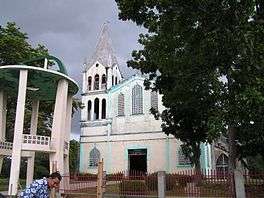 Roman Catholic Church, Candijay
References
- ↑ "Municipality". Quezon City, Philippines: Department of the Interior and Local Government. Retrieved 31 May 2013.
- ↑ "Province: Bohol". PSGC Interactive. Quezon City, Philippines: Philippine Statistics Authority. Retrieved 12 November 2016.
- 1 2 3 4 Census of Population (2015). "Region VII (Central Visayas)". Total Population by Province, City, Municipality and Barangay. PSA. Retrieved 20 June 2016.
- 1 2 Census of Population and Housing (2010). "Region VII (Central Visayas)". Total Population by Province, City, Municipality and Barangay. NSO. Retrieved 29 June 2016.
- ↑ Censuses of Population (1903–2007). "Region VII (Central Visayas)". Table 1. Population Enumerated in Various Censuses by Province/Highly Urbanized City: 1903 to 2007. NSO.
- ↑ "Province of Bohol". Municipality Population Data. Local Water Utilities Administration Research Division. Retrieved 17 December 2016.
| Wikimedia Commons has media related to Candijay. |
External links
Places adjacent to Candijay, Bohol | |
|---|---|