Burlington, New York
| Burlington, New York | |
|---|---|
| Town | |
 Burlington, Otsego County, New York | |
| Coordinates: 42°43′42″N 75°8′29″W / 42.72833°N 75.14139°W | |
| Country | United States |
| State | New York |
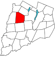
| County | Otsego |
| Area[1] | |
| • Total | 45.01 sq mi (116.58 km2) |
| • Land | 44.89 sq mi (116.27 km2) |
| • Water | 0.12 sq mi (0.32 km2) |
| Elevation | 1,959 ft (597 m) |
| Population (2010) | |
| • Total | 1,140 |
| • Estimate (2016)[2] | 1,084 |
| • Density | 24.15/sq mi (9.32/km2) |
| Time zone | UTC-5 (Eastern (EST)) |
| • Summer (DST) | UTC-4 (EDT) |
| ZIP code | 13315 |
| Area code(s) | 607 |
| FIPS code | 36-11209 |
| GNIS feature ID | 0978766 |
Burlington is a town in Otsego County, New York, United States. The population was 1,140 at the 2010 census.
The Town of Burlington is in the northwest part of the county and is north of Oneonta.
Geography
According to the United States Census Bureau, the town has a total area of 45.0 square miles (117 km2), of which, 45.0 square miles (117 km2) of it is land and 0.1 square miles (0.26 km2) of it (0.13%) is water. 1878 history of the county states the acreage as 27,217, with an assessed valuation of $421,450 and equalized valuation of $473,576.
North-south highway New York State Route 51 and east-west highway New York State Route 80 intersect at Barrett Corners. North-south highway county route 16 and east-west highway New York State Route 80 intersects at Burlington Green.
Butternut Creek and Wharton Creek are important waterways in the town.
History

Early settlers came from New England. Township named after Burlington, New Jersey by William Cooper and Andrew Craig, early land patent owners. At an early time the Butternut Creek was dubbed "Burlington Creek" as well but the name didn't stick.
Burlington was formed from the Town of Otsego, April 10, 1792. It retained its original dimensions until 1797, when Pittsfield (and what would come to be New Lisbon) was set off. It was further diminished in area by the erection of Edmeston, in 1808.
The 1878 history describes the community of Burlington Green as having two churches, a general store, lawyer office, hotel, gristmill, creamery, two blacksmith shops, two wagon shops, a cooper and shoe shop and photography studio, but "This village at one time was a place of much more mercantile and manufacturing interest than at present, having a comb-factory, a hattery, two tanneries, an iron-foundry, a furniture-factory, three stores, two hotels, a cloth-dressing and wool carding-factory, and a card factory." The heavily textile based economy of the Butternut Valley was an influence in the number of sheep and immigrants that arrived from Scotland and established the United Presbyterian Church at Burlington Green June 8, 1835.
Notable residents
- Benjamin F. Angel, (1815–1894), born in Burlington, former ambassador of the United States[3]
- Artemas Holdredge 1823 -, cheese manufacturer, patented the idea of packaging cheese in rectangular boxes for easier shipping and shelf stacking in stores, as opposed to traditional wheel or round cheese and boxes.
- Levi Miller, Revolutionary War veteran, relocated to Burlington, NY after being forced to sell his family cow to pay church tax in Massachusetts, (there is a question of family involvement in Shay's Rebellion?), established a gun factory on the Butternut north of Burlington Green.
- Jedediah Peck, a.k.a. "Ploughjogger", one of several Lyme. CT natives to pioneer in this town, Revolutionary War soldier, millwright, surveyor, essayist, first town supervisor and member NY State assembly, he promoted the establishment of public schools, and the abolishment of debtors' prison in NY state. Arguing in favor of rule by commoners rather than elistists he wrote: "The people can never mean to do anything that will not advance the public good, and it is only under momentary delusion that they can act wrong." Antagonist of Federalist everywhere he gathered petition signatures against the Alien and Sedition Acts, which led to his arrest by Judge Cooper and transport in open wagon in the fall of 1799, to New York City for trial. It is claimed sympathy at the sight of him convinced the weight of the New York electoral votes to be cast in favor of Thomas Jefferson. Today there are several state historical markers for Peck, one at his grave on route 80 east of Burlington Green, and two on route 20 in Richfield, commemorating his work as a millwright.
- Parley P. Pratt (1807–1857), born in Burlington, was an early leader of the Latter Day Saint movement whose writings became a significant early nineteenth-century exposition of the Latter Day Saint faith.
- Daniel H. Richards (1808-1877), Wisconsin legislator and newspaper editor, was born in Burlington.[4]
- Arthur J. "Putt" Telfer, early photographer, studio in Cooperstown but family homestead was at intersection of Schwerd Roads near Patent in a house since removed for the Marcy South powerline.
- George Eaton Sutherland (1847-1899), Wisconsin legislator and judge[5]
- William Hulbert (1832-1882), Born in Burlington Flats,[6] President of the Chicago White Stockings baseball club and the National League and member of the Baseball Hall of Fame[7]
Demographics
| Historical population | |||
|---|---|---|---|
| Census | Pop. | %± | |
| 1820 | 2,457 | — | |
| 1830 | 2,459 | 0.1% | |
| 1840 | 2,154 | −12.4% | |
| 1850 | 1,835 | −14.8% | |
| 1860 | 1,818 | −0.9% | |
| 1870 | 1,476 | −18.8% | |
| 1880 | 1,599 | 8.3% | |
| 1890 | 1,334 | −16.6% | |
| 1900 | 1,263 | −5.3% | |
| 1910 | 1,108 | −12.3% | |
| 1920 | 999 | −9.8% | |
| 1930 | 913 | −8.6% | |
| 1940 | 956 | 4.7% | |
| 1950 | 959 | 0.3% | |
| 1960 | 809 | −15.6% | |
| 1970 | 803 | −0.7% | |
| 1980 | 1,045 | 30.1% | |
| 1990 | 1,036 | −0.9% | |
| 2000 | 1,085 | 4.7% | |
| 2010 | 1,140 | 5.1% | |
| Est. 2016 | 1,084 | [2] | −4.9% |
| U.S. Decennial Census[8] | |||
As of the census[9] of 2000, there were 1,085 people, 392 households, and 301 families residing in the town. The population density was 24.1 people per square mile (9.3/km²). There were 500 housing units at an average density of 11.1 per square mile (4.3/km²). The racial makeup of the town was 97.14% White, 0.18% African American, 0.18% Native American, 0.28% Asian, 0.37% from other races, and 1.84% from two or more races. Hispanic or Latino of any race were 1.66% of the population.
There were 392 households out of which 36.2% had children under the age of 18 living with them, 65.1% were married couples living together, 7.9% had a female householder with no husband present, and 23.2% were non-families. 18.6% of all households were made up of individuals and 8.2% had someone living alone who was 65 years of age or older. The average household size was 2.76 and the average family size was 3.08.
In the town, the population was spread out with 26.5% under the age of 18, 7.7% from 18 to 24, 29.3% from 25 to 44, 22.6% from 45 to 64, and 13.9% who were 65 years of age or older. The median age was 38 years. For every 100 females, there were 103.6 males. For every 100 females age 18 and over, there were 94.6 males.
The median income for a household in the town was $36,823, and the median income for a family was $42,500. Males had a median income of $28,000 versus $20,667 for females. The per capita income for the town was $15,184. About 7.4% of families and 11.8% of the population were below the poverty line, including 11.5% of those under age 18 and 17.1% of those age 65 or over.
Communities and locations in the Town of Burlington
- Barrett Corners – A hamlet south of Burlington Flats on NY-51 at its intersection with NY-80.
- Basswood Pond – Artificial lake on headwaters of the Butternut Creek built by NYS about 1961 as a day use area west of county route 16 in the north part of town. Inside Basswood Pond State Park.
- Beverly Inn Corners – A hamlet north of Burlington Flats on NY-51.
- Briar Hill – An elevation located east or Burlington.
- Burlington Flats – A hamlet in the western part of the town located on route NY-51. Originally called "Walbridge Flats".
- Burlington – The hamlet of Burlington is located on NY-80. Unofficially it is still called by its original name "Burlington Green" or simply "The Green".
- Chapinville – A hamlet south of Burlington Flats on NY-51.
- Cranberry Bog – Bog or vly in the southeast section of town on the headwaters of the Otego Creek.
- Gardner Pond – A small pond located south-southwest of West Burlington.
- Klock Hill – An elevation southwest of Burlington.
- Methodist Hollow – A location near the south town line.
- Patent – A hamlet near the southeast corner of town.
- Pecktown – A hamlet near the north town line. Formally referred to as Wharton.
- Pigeon Hill – An elevation in the northeast corner of the town. Partially in the Town of Exeter.
- Rice Hill – An elevation east of West Burlington.
- Round Top – A hill north of NY-80.
- West Burlington – A hamlet near the west town line on conjoined routes NY-51 and NY-80.
- Wharton – A historic location in the northwest part of the town.
- Wharton Creek – A stream flowing through the west part of the town.
References
History of Otsego County, New York 1740-1878, Chapter XXX Town of Burlington, Published by Everts and Fariss 1878.
- ↑ "2016 U.S. Gazetteer Files". United States Census Bureau. Retrieved Jul 5, 2017.
- 1 2 "Population and Housing Unit Estimates". Retrieved June 9, 2017.
- ↑ Who Was Who in America, Historical Volume, 1607-1896. Chicago: Marquis Who's Who. 1963.
- ↑ 'Wisconsin Blue Book 1877,' Biographical Sketch of Daniel Hamilton Richards, pg. 329
- ↑ 'Wisconsin Blue Book 1881.' Biographical Sketch of George E. Sutherland, pg. 498-499
- ↑ Achorn, Edward (2013). "The Summer of Beer and Whiskey: How Brewers, Barkeeps, Rowdies, Immigrants, and a Wild Pennant Fight Made Baseball America's Game": 20. ISBN 978-1-61039-260-0.
- ↑ "William Hulbert". Baseball Hall of Fame. Retrieved 2018-05-19.
- ↑ "Census of Population and Housing". Census.gov. Archived from the original on May 12, 2015. Retrieved June 4, 2015.
- ↑ "American FactFinder". United States Census Bureau. Archived from the original on 2013-09-11. Retrieved 2008-01-31.
External links
Municipalities and communities of Otsego County, New York, United States | ||
|---|---|---|
| City | 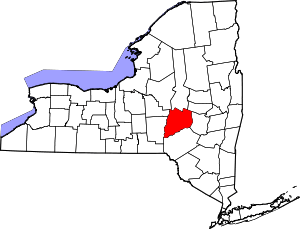 | |
| Towns | ||
| Villages | ||
| CDPs | ||
| Other hamlets |
| |
| Footnotes | ‡This populated place also has portions in an adjacent county or counties | |
Coordinates: 42°43′22″N 75°07′32″W / 42.72278°N 75.12556°W