Portlandville, New York
| Portlandville, New York | |
|---|---|
| Hamlet | |
 Portlandville, New York  Portlandville, New York | |
| Coordinates: 42°31′49″N 74°58′02″W / 42.53028°N 74.96722°WCoordinates: 42°31′49″N 74°58′02″W / 42.53028°N 74.96722°W | |
| Country | United States |
| State | New York |
| County | Otsego |
| Town | Milford |
| Elevation | 1,152 ft (351 m) |
| Time zone | UTC-5 (Eastern (EST)) |
| • Summer (DST) | UTC-4 (EDT) |
| ZIP code | 13834 |
| Area code(s) | 607 |
| GNIS feature ID | 961002[1] |
Portlandville is a hamlet in Otsego County, New York, United States. The community is located along the Susquehanna River and New York State Route 28 7.3 miles (11.7 km) northeast of Oneonta. Portlandville has a post office with ZIP code 13834, which opened on April 9, 1828.[2][3]
References
- ↑ "Portlandville". Geographic Names Information System. United States Geological Survey.
- ↑ United States Postal Service. "USPS - Look Up a ZIP Code". Retrieved October 7, 2017.
- ↑ "Postmaster Finder - Post Offices by ZIP Code". United States Postal Service. Retrieved October 7, 2017.
Municipalities and communities of Otsego County, New York, United States | ||
|---|---|---|
| City | 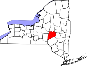 | |
| Towns | ||
| Villages | ||
| CDPs | ||
| Other hamlets |
| |
| Footnotes | ‡This populated place also has portions in an adjacent county or counties | |
This article is issued from
Wikipedia.
The text is licensed under Creative Commons - Attribution - Sharealike.
Additional terms may apply for the media files.