Edmeston (CDP), New York
| Edmeston, New York | |
|---|---|
| Census-designated place | |
 Edmeston, New York Location within the state of New York | |
| Coordinates: 42°41′52″N 75°14′38″W / 42.69778°N 75.24389°WCoordinates: 42°41′52″N 75°14′38″W / 42.69778°N 75.24389°W | |
| Country | United States |
| State | New York |
| County | Otsego |
| Town | Edmeston |
| Area | |
| • Total | 4.4 sq mi (11.3 km2) |
| • Land | 4.4 sq mi (11.3 km2) |
| • Water | 0.0 sq mi (0.0 km2) |
| Elevation | 1,210 ft (370 m) |
| Population (2010) | |
| • Total | 657 |
| • Density | 150/sq mi (58/km2) |
| Time zone | UTC-5 (Eastern (EST)) |
| • Summer (DST) | UTC-4 (EDT) |
| Area code(s) | 607 |
Edmeston is a census-designated place (CDP) forming the central settlement of the town of Edmeston in Otsego County, New York, United States. The population of the CDP was 657 at the 2010 census.[1]
Geography
Edmeston is located at 42°41′52″N 75°14′38″W / 42.69778°N 75.24389°W (42.69177, -75.25326).[2]
According to the United States Census Bureau, the CDP has a total area of 4.4 square miles (11.3 km2), all of it land.[3]
References
- ↑ "Profile of General Population and Housing Characteristics: 2010 Demographic Profile Data (DP-1): Edmeston CDP, New York". U.S. Census Bureau, American Factfinder. Archived from the original on September 11, 2013. Retrieved July 13, 2012.
- ↑ "Edmeston, NY". U.S. Geological Survey 7.5-minute topographic map series, mapper.acme.com
- ↑ "Geographic Identifiers: 2010 Demographic Profile Data (G001): Edmeston CDP, New York". U.S. Census Bureau, American Factfinder. Archived from the original on September 11, 2013. Retrieved July 13, 2012.
Municipalities and communities of Otsego County, New York, United States | ||
|---|---|---|
| City | 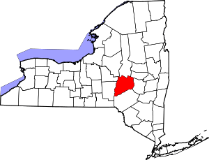 | |
| Towns | ||
| Villages | ||
| CDPs | ||
| Other hamlets |
| |
| Footnotes | ‡This populated place also has portions in an adjacent county or counties | |
This article is issued from
Wikipedia.
The text is licensed under Creative Commons - Attribution - Sharealike.
Additional terms may apply for the media files.