Brush Creek Township, Washington County, Arkansas
| Township of Brush Creek | |
|---|---|
| Township | |
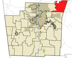 Brush Creek Township in Washington County, Arkansas | |
| Coordinates: 36°11′30″N 93°57′46″W / 36.19167°N 93.96278°WCoordinates: 36°11′30″N 93°57′46″W / 36.19167°N 93.96278°W | |
| Country |
|
| State |
|
| County | Washington |
| Established | before 1836[1] |
| Area | |
| • Total | 39.04 sq mi (101.1 km2) |
| • Land | 36.96 sq mi (95.7 km2) |
| • Water | 2.08 sq mi (5.4 km2) |
| Elevation | 1,306 ft (398 m) |
| Population (2010) | |
| • Total | 2,877 |
| • Density | 77.8/sq mi (30.0/km2) |
| Time zone | UTC-6 (CST) |
| • Summer (DST) | UTC-5 (CDT) |
| Area code(s) | 479 |
| GNIS feature ID | 69780 |
| U.S. Geological Survey Geographic Names Information System: Brush Creek Township, Washington County, Arkansas | |
Brush Creek Township is one of thirty-seven townships in Washington County, Arkansas, USA.[2] As of the 2010 census, its unincorporated population was 2,877.
Geography
According to the United States Census Bureau, Brush Creek Township covers an area of 36.96 square miles (95.7 km2) of land and 2.08 square miles (5.4 km2) of water for 39.04 square miles (101.1 km2) in total area.[2] Brush Creek Township gave some area up to Goshen Township in 1879.[1]
Cities, towns, villages
Cemeteries
The township contains Joyce Cemetery and Morriss Cemetery.
Major routes


References
External links
Places adjacent to Brush Creek Township, Washington County, Arkansas | ||||||||||
|---|---|---|---|---|---|---|---|---|---|---|
| ||||||||||

This article is issued from
Wikipedia.
The text is licensed under Creative Commons - Attribution - Sharealike.
Additional terms may apply for the media files.