Brownsville–Harlingen–Raymondville CSA
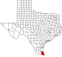
The Brownsville–Harlingen–Raymondville Combined Statistical Area is made up of two counties in the Rio Grande Valley region of Texas. The statistical area consists of the Brownsville–Harlingen Metropolitan Statistical Area and the Raymondville Micropolitan Statistical Area. A 2013 census estimate puts the population at 439,197.
Counties
Communities
Cities
- Brownsville (Principal city)
- Harlingen (Principal city)
- La Feria
- Los Fresnos
- Lyford
- Palm Valley
- Port Isabel
- Raymondville (Principal city)
- Rio Hondo
- San Benito
- San Perlita
Towns
Villages
Census-designated places
Demographics
At the 2010 census,[1] there were 428,354 people, 102,851 households and 84,537 families residing within the CSA. The racial makeup of the CSA was 79.73% White, 0.58% African American, 0.44% Native American, 0.46% Asian, 0.03% Pacific Islander, 16.46% from other races, and 2.30% from two or more races. Hispanic or Latino of any race were 84.42% of the population.
The median household income was $24,135 and the median family income was $26,465. Males had a median income of $21,231 versus $16,848 for females. The per capita income for the CSA was $10,191.
See also
References
- ↑ "American FactFinder". United States Census Bureau. Archived from the original on 2013-09-11. Retrieved 2008-01-31.
