Brigus
| Brigus | ||
|---|---|---|
| Town | ||
 | ||
| ||
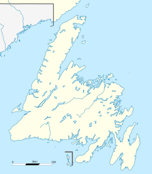 Brigus Location of Brigus in Newfoundland | ||
| Coordinates: 47°32′06″N 53°12′29″W / 47.53500°N 53.20806°WCoordinates: 47°32′06″N 53°12′29″W / 47.53500°N 53.20806°W | ||
| Country |
| |
| Province |
| |
| Census division | 1 | |
| Settled | 1612 | |
| Incorporated (town) | July 21, 1964 | |
| Government | ||
| • Mayor | Byron Rodway | |
| • MHA | Tom Hedderson (Harbour Main) | |
| • MP | Scott Andrews (Avalon) | |
| Area | ||
| • Total | 11.57 km2 (4.47 sq mi) | |
| Elevation | 30 m (100 ft) | |
| Population (2016) | ||
| • Total | 723 | |
| • Density | 62.5/km2 (162/sq mi) | |
| Time zone | UTC-3:30 (Newfoundland Standard) | |
| • Summer (DST) | UTC-2:30 (Newfoundland Daylight) | |
| Postal code span | A0A-1K0 | |
| Area code(s) | 709 | |
| Highways |
| |
| Website |
www | |

|
| |
| Location |
Brigus Newfoundland Canada |
|---|---|
| Coordinates | 47°32′54.5″N 53°10′55.5″W / 47.548472°N 53.182083°W |
| Year first constructed | 1885 |
| Foundation | concrete base |
| Construction | cast iron tower |
| Tower shape | cylindrical tower with balcony and lantern |
| Markings / pattern | tower painted with red and white vertical stripes |
| Height | 9.5 metres (31 ft) |
| Focal height | 34.5 metres (113 ft) |
| Range | 8 nautical miles (15 km; 9.2 mi) |
| Characteristic | Fl W 3s. |
| Admiralty number | H0479 |
| CHS number | CCG 488 |
| NGA number | 1788 |
| ARLHS number | CAN-832 |
| Managing agent | Canadian Coast Guard[1][2] |
Brigus is a small fishing community located in Conception Bay, Newfoundland and Labrador, Canada. Brigus was home to Captain Bob Bartlett and the location of his residence Hawthorne Cottage.
Incorporated in July 1964, Brigus' first Mayor was Fred Bartlett. The present Mayor is Byron Rodway. Rev. R. Wells was the first Clergy Mayor elected in the Province.
Geography
Located in a sheltered bay it has been home to many fishermen and a strategic location in early times. Brigus is located adjacent to Cuper's Cove (modern day Cupids) an English settlement established in 1610 by John Guy on behalf of Bristol's Society of Merchant Venturers.
Brigus is located approximately 80 km west of St. John's, and is accessible via Route 70-A just 18 km from the Trans Canada Highway (TCH).
Demography
| Population in 2001 | 784 |
| Population change from 1996 | -13.1% |
| Median age | 41.9 |
| Number of families | 255 |
| Number of married couples | 195 |
| Total number of dwellings | 300 |
| Catholic | 36.1% |
| Protestant | 63.9% |
| Land Area (km².) | 11.57 |
History
The name Brigus comes from the Brickhouse which was the name of an old town in England. Brigus' history dates back to around 1612, when John Guy sold half of the Harbour to the Spracklin family. At this time Brigus was mostly settled by people from England, Ireland, and Wales. During King William's War, this village was raided in the Avalon Peninsula Campaign.
Brigus is famous for its sea Captains, it was in 1819 when Captain William Munden built the schooner Four Brothers, the first one hundred ton schooner in Newfoundland (built 1819).
There were many "Arctic Heroes" that came from this historic town:
- Captain John Bartlett sailed with the American explorer Isaac Israel Hayes and also with Admiral Robert Peary
- Captain Sam Bartlett who sailed with Peary
- Captain Robert Bartlett who was in charge of the S.S. Roosevelt when Peary reached the North Pole, who later survived the wreck of the Karluk, and who later helmed the schooner Effie M. Morrissey
- Captain Arthur Bartlett
- Captain William Norman who rescued Admiral Adolphus Greely
- Captain Isaac Bartlett who rescued Captain Tyson and crew after drifting on an iceberg for 1500 miles
- Captain William Bartlett, known as "the Commodore of the sealing fleet in Newfoundland".
Attractions
Brigus is a popular tourist stop, renowned for its scenic qualities and places of interest. Among these are the site of The Vindicator, where the Brigus newspaper was printed at the turn of the 20th century; the Convent of Mercy, built in 1860 for the Mercy Sisters who came from Ireland in 1861; the local Orange Lodge; Hawthorne Cottage, now a National Historic Site of Canada; "The Tunnel" bored through solid rock on the waterfront in 1860 to provide access to a deep water berth for the Bartlett sailing ships; the Stone Barn Museum; Jubilee Club, the meeting place of the "Merchant Princes of Brigus" from the late 19th century to the mid-20th century; St. George' s Anglican Church, consecrated in 1845; Brigus United Church, dedicated in 1875 on the site of an earlier church; and the Roman Catholic Church, built in 1832.
.jpg)
See also
References
- ↑ Southeastern Newfoundland The Lighthouse Directory. University of North Carolina at Chapel Hill. Retrieved 6 February 2017
- ↑ List of Lights, Pub. 110: Greenland, The East Coasts of North and South America (Excluding Continental U.S.A. Except the East Coast of Florida) and the West Indies (PDF). List of Lights. United States National Geospatial-Intelligence Agency. 2016.
Further reading
- John Northway Leamon, 1998, Brigus: Past Glory, Present Splendour, St. John's: Harry Cuff Publications.
External links
| Wikimedia Commons has media related to Brigus, Newfoundland and Labrador. |
- Official Town Website
- Aids to Navigation Canadian Coast Guard
