Boonsboro, Maryland
| Town of Boonsboro | |
|---|---|
| Town | |
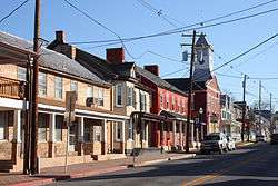 Downtown Boonsboro | |
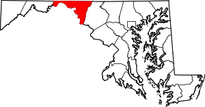
 Location in Maryland | |
| Coordinates: 39°30′30″N 77°39′14″W / 39.50833°N 77.65389°WCoordinates: 39°30′30″N 77°39′14″W / 39.50833°N 77.65389°W | |
| Country | United States |
| State | Maryland |
| County | Washington |
| Founded | 1792 |
| Incorporated | 1831 |
| Government | |
| • Mayor | Howard W. Long |
| Area[1] | |
| • Town | 2.91 sq mi (7.54 km2) |
| • Land | 2.90 sq mi (7.51 km2) |
| • Water | 0.01 sq mi (0.03 km2) 0.34% |
| • Urban | 1.34 sq mi (3.43 km2) |
| Elevation | 545 ft (166 m) |
| Population (2010)[2] | |
| • Town | 3,336 |
| • Estimate (2016)[3] | 3,510 |
| • Density | 1,100/sq mi (440/km2) |
| Time zone | UTC-5 (Eastern) |
| • Summer (DST) | UTC-4 (Eastern) |
| ZIP code | 21713 |
| Area code(s) | 301, 240 |
| FIPS code | 24-08625 |
| GNIS feature ID | 0589787 |
| Website | |
Boonsboro is a town in Washington County, Maryland, United States, located at the foot of South Mountain. It nearly borders Frederick County and is proximate to the Antietam National Battlefield. The population was 3,336 at the 2010 census.
History
Local lore asserts Boonsboro was founded by George Boone, a cousin of Daniel Boone, and was originally named "Margaretsville" after his wife. The town was incorporated as Boonesborough in 1831. Local newspapers and villagers preferred the name Boonsboro. The former name was used on some documents as late as 1903.
Boonsboro was a key town during the American Civil War. Two battles were fought in its present borders. The town was also used to keep wounded soldiers after the Battle of Antietam in September 1862.
Boonsboro lies on what used to be the National Road. Today it is known as either the Old National Pike or Alt-U.S. 40. In Boonsboro it is Main Street. The route was originally established as a road improvement project in 1758 to shorten travel between Fredericktown and Fort Frederick during the Seven Years War.[4] The route began from the existing (old) road at today's Marker road, passed through Turner's Gap, Boonsboro and turned west along today's MD. Rt. 68 to Williamsport.[5] The route from Boonsboro to Funkstown was later adopted as part of the National Turnpike route.
The town suffered a fire at the former Asaro's (its successor Vesta moved to the building across) in 2007, and a fire at the former inn in 2008. That fire completely gutted the inn, which was on the verge of being renovated and reopened. The Inn BoonsBoro finally opened a year later; it is owned by best-selling romance novelist Nora Roberts.[6]
The Boonsboro Historic District, Bowman House, Ingram-Schipper Farm, Keedy House, St. Mark's Episcopal Church, and Washington Monument are listed on the National Register of Historic Places.[7]
Geography
Boonsboro is located at 39°30′30″N 77°39′14″W / 39.50833°N 77.65389°W.[8]
According to the United States Census Bureau, the town has a total area of 2.91 square miles (7.54 km2), of which, 2.90 square miles (7.51 km2) is land and 0.01 square miles (0.03 km2) is water.[1]
Demographics
| Historical population | |||
|---|---|---|---|
| Census | Pop. | %± | |
| 1850 | 943 | — | |
| 1860 | 864 | −8.4% | |
| 1870 | 835 | −3.4% | |
| 1880 | 859 | 2.9% | |
| 1890 | 766 | −10.8% | |
| 1900 | 700 | −8.6% | |
| 1910 | 759 | 8.4% | |
| 1920 | 350 | −53.9% | |
| 1930 | 369 | 5.4% | |
| 1940 | 938 | 154.2% | |
| 1950 | 1,071 | 14.2% | |
| 1960 | 1,211 | 13.1% | |
| 1970 | 1,410 | 16.4% | |
| 1980 | 1,908 | 35.3% | |
| 1990 | 2,445 | 28.1% | |
| 2000 | 2,803 | 14.6% | |
| 2010 | 3,336 | 19.0% | |
| Est. 2016 | 3,510 | [3] | 5.2% |
| U.S. Decennial Census[9] | |||
2010 census
As of the census[2] of 2010, there were 3,336 people, 1,237 households, and 879 families residing in the town. The population density was 1,150.3 inhabitants per square mile (444.1/km2). There were 1,327 housing units at an average density of 457.6 per square mile (176.7/km2). The racial makeup of the town was 95.4% White, 2.1% African American, 0.1% Native American, 1.0% Asian, 0.1% Pacific Islander, 0.5% from other races, and 0.7% from two or more races. Hispanic or Latino of any race were 2.7% of the population.
There were 1,237 households of which 37.3% had children under the age of 18 living with them, 55.8% were married couples living together, 10.4% had a female householder with no husband present, 4.9% had a male householder with no wife present, and 28.9% were non-families. 24.3% of all households were made up of individuals and 10.5% had someone living alone who was 65 years of age or older. The average household size was 2.58 and the average family size was 3.06.
The median age in the town was 40.8 years. 24.3% of residents were under the age of 18; 6.7% were between the ages of 18 and 24; 26.1% were from 25 to 44; 26.6% were from 45 to 64; and 16.2% were 65 years of age or older. The gender makeup of the town was 46.6% male and 53.4% female.
2000 census
As of the census[10] of 2000, there were 2,803 people, 1,068 households, and 723 families residing in the town. The population density was 1,851.0 people per square mile (716.7/km²). There were 1,109 housing units at an average density of 732.3 per square mile (283.6/km²). The racial makeup of the town was 98.04% White, 0.75% African American, 0.11% Native American, 0.18% Asian, 0.04% Pacific Islander, 0.14% from other races, and 0.75% from two or more races. Hispanic or Latino of any race were 0.75% of the population.
There were 1,068 households out of which 34.5% had children under the age of 18 living with them, 52.2% were married couples living together, 11.8% had a female householder with no husband present, and 32.3% were non-families. 27.2% of all households were made up of individuals and 15.4% had someone living alone who was 65 years of age or older. The average household size was 2.47 and the average family size was 3.04.
In the town, the population was spread out with 25.5% under the age of 18, 5.9% from 18 to 24, 28.4% from 25 to 44, 20.3% from 45 to 64, and 19.9% who were 65 years of age or older. The median age was 40 years. For every 100 females, there were 85.3 males. For every 100 females age 18 and over, there were 76.5 males.
The median income for a household in the town was $40,476, and the median income for a family was $48,155. Males had a median income of $37,683 versus $25,673 for females. The per capita income for the town was $19,430. About 7.8% of families and 7.9% of the population were below the poverty line, including 6.4% of those under age 18 and 14.1% of those age 65 or over.
Government
Boonsboro has a 7-member Town Council, which serves as the legislative body of the Town. In Boonsboro, from 1831 through 1939, Mayors (originally called Burgesses) were elected annually. From 1940 through 1975, they served two-year terms. Since 1976, Mayors have been chosen for four-year terms, except for the present mayor who has been in office since 1988.
Boonsboro's current Mayor is Howard W. Long.
Previous Mayors include:[11]
|
|
|
|
|
Education
Boonsboro is served by a 90-acre (360,000 m2) educational complex. It consists of the following schools:
The current principal of Boonsboro High School is Sherry Hamilton.[12]
Notable people
- Janet Doub Erickson, artist and educator (born in Hagerstown Hospital to a Boonsboro farming family, she spent her childhood there)
- William Thomas Hamilton, 38th Governor of Maryland, U.S. Senator, & U.S. Congressman for Maryland's 2nd District and 4th District. Born in Boonsboro on 8 September 1820.
- The late Charlotte Winters, 109, once the oldest surviving female American World War I veteran. Served in the navy.
- Nora Roberts, author of over 170 romantic novels and entrepreneur of several businesses in Boonsboro.
Area attractions
- Crystal Grottoes
- Washington Monument State Park
- Greenbrier State Park
- Old South Mountain Inn
- Stoney Creek Farm
- South Mountain State Battlefield
- Boonsboro cantaloupes
- Inn Boonsboro (Themed Bed and Breakfast owned by Nora Roberts)
- Boonesborough Museum of History
- Boonsboro Trolley Museum
- Bowman House
References
- 1 2 "US Gazetteer files 2010". United States Census Bureau. Archived from the original on 2012-01-24. Retrieved 2013-01-25.
- 1 2 "American FactFinder". United States Census Bureau. Retrieved 2013-01-25.
- 1 2 "Population and Housing Unit Estimates". Retrieved June 9, 2017.
- ↑ 1758 Frederick Co. court records
- ↑ Older, Curtis (2009). The Braddock Expedition and Fox's Gap in Maryland. Heritage Books. ISBN 1585493015.
- ↑ La Gorce, Tammy (April 29, 2010). "Maryland's Civil War Country Seeks a Softer Side". The New York Times. Retrieved April 6, 2013.
- ↑ National Park Service (2010-07-09). "National Register Information System". National Register of Historic Places. National Park Service.
- ↑ "US Gazetteer files: 2010, 2000, and 1990". United States Census Bureau. 2011-02-12. Retrieved 2011-04-23.
- ↑ "Census of Population and Housing". Census.gov. Archived from the original on May 12, 2015. Retrieved June 4, 2015.
- ↑ "American FactFinder". United States Census Bureau. Archived from the original on 2013-09-11. Retrieved 2008-01-31.
- ↑ http://www.msa.md.gov/msa/mdmanual/37mun/boonsboro/html/bmayors.html
- ↑ Message from BHS Principal Archived March 21, 2012, at the Wayback Machine. Retrieved 13 September 2011.
External links
| Wikimedia Commons has media related to Boonsboro, Maryland. |
| Wikivoyage has a travel guide for Boonsboro. |